Datu, Nepal
| Dattu दत्तु | |
|---|---|
| Village development committee | |
| Country | Nepal |
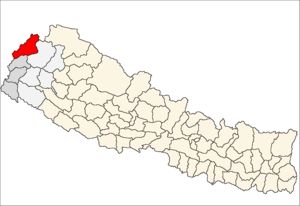
| Zone | Mahakali Zone |
| District | Darchula District |
| Population (1991) | |
| • Total | 1,832 |
| Time zone | UTC+5:45 (Nepal Time) |
Dattu is a village development committee in Darchula District in the Mahakali Zone of western Nepal. At the time of the 1991 Nepal census it had a population of 1832 people living in 344 individual households. It consist of 9 wards: Sakar, Thapala, Mali Dattu, Bait, Ulaini, Tali Dattu, Udyai, Kholi, Chuchai. The south part is separated by from India by the Mahakali River, and the Indian markets Baluwako and Go Ghatiwagad are connected by a hanging bridge, which helps access to Indian markets and trading business among residents and others nearby. The cultural relationship with India has also strengthened the ties among both countries' residents.[1]
References
- ↑ "Nepal Census 2001". Nepal's Village Development Committees. Digital Himalaya. Archived from the original on 12 October 2008. Retrieved 19 November 2008.
External links
Headquarters: Khalanga | ||
| Municipalities |
|  |
| Rural municipalities |
| |
| Former VDCs | ||
List of municipalities and rural municipalities of Nepal | ||
This article is issued from
Wikipedia.
The text is licensed under Creative Commons - Attribution - Sharealike.
Additional terms may apply for the media files.