Darlingtonia, California
Coordinates: 41°50′10″N 123°56′35″W / 41.83611°N 123.94306°W
| Darlingtonia | |
|---|---|
| Unincorporated community | |
 Darlingtonia Location in California  Darlingtonia Darlingtonia (the US) | |
| Coordinates: 41°50′10″N 123°56′35″W / 41.83611°N 123.94306°W | |
| Country | United States |
| State | California |
| County | Del Norte County |
| Elevation[1] | 463 ft (141 m) |
Darlingtonia is an unincorporated community in Del Norte County, California. It is located on the south bank of the Middle Fork of the Smith River 1.5 miles (2.4 km) east-southeast of Gasquet,[2] at an elevation of 463 feet (141 m).
References
- ↑ U.S. Geological Survey Geographic Names Information System: Darlingtonia, California
- ↑ Durham, David L. (1998). California's Geographic Names: A Gazetteer of Historic and Modern Names of the State. Clovis, Calif.: Word Dancer Press. p. 46. ISBN 1-884995-14-4.
External links
Municipalities and communities of Del Norte County, California, United States | ||
|---|---|---|
| City | 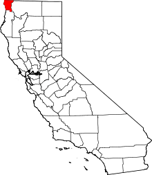 | |
| CDPs | ||
| Unincorporated communities | ||
| Indian reservations | ||
| Ghost towns |
| |
This article is issued from
Wikipedia.
The text is licensed under Creative Commons - Attribution - Sharealike.
Additional terms may apply for the media files.