Dangibari
| Dangibari डाँगीबारी | |
|---|---|
| Village development committee | |
 Dangibari Location in Nepal | |
| Coordinates: 26°35′N 87°56′E / 26.58°N 87.93°ECoordinates: 26°35′N 87°56′E / 26.58°N 87.93°E | |
| Country |
|
| Zone | Mechi Zone |
| District | Jhapa District |
| Population (1991) | |
| • Total | 7,472 |
| Time zone | UTC+5:45 (Nepal Time) |
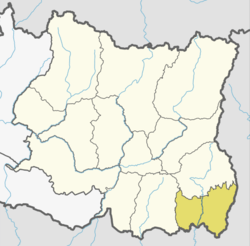
Dangibari is a village development committee in Jhapa District in the Mechi Zone of south-eastern Nepal. At the time of the 1991 Nepal census it had a population of 7472.[1]
It borders with Ghaliadubba, Charpane, Garamani, Chakchaki, Saranamati and Surunga VDCs. It is divided to 9 wards. The predominant caste is Brahman, Kshetri, Rajbanshi, limbu Santhal among others. Basic infrastructural development is satisfactory here including school, roads, electricity, drinking water and irrigation. A major fraction of alluvial fertile land of Jhapa lies here. Various notable figures in National politics and bureaucracy belongs to this place. A major touristic and historical religious site Barhadashi (kuti danda) lies at 8th ward of this VDC.
References
- ↑ "Nepal Census 2001". Nepal's Village Development Committees. Digital Himalaya. Archived from the original on 12 October 2008. Retrieved 24 November 2008.
This article is issued from
Wikipedia.
The text is licensed under Creative Commons - Attribution - Sharealike.
Additional terms may apply for the media files.
