Dammersfeld Ridge
| Dammersfeld Ridge | |
|---|---|
 The Dammersfeldkuppe | |
| Highest point | |
| Peak | Dammersfeldkuppe |
| Elevation | 927.9 m above NHN |
| Geography | |
  | |
| State |
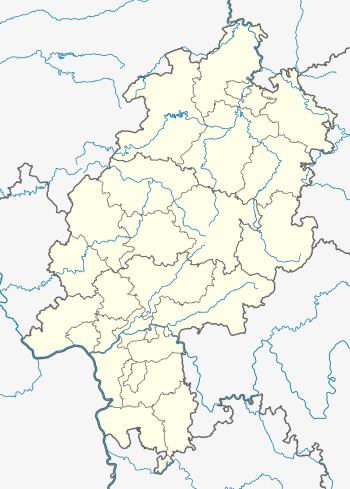
Counties of Bad Kissingen and Rhön-Grabfeld, Bavaria, and county of Fulda, Hesse, |
| Range coordinates | 50°23′49″N 9°51′44″E / 50.3969°N 9.8621°ECoordinates: 50°23′49″N 9°51′44″E / 50.3969°N 9.8621°E |
| Parent range | Southern High Rhön, High Rhön, Rhön |
The Dammersfeld Ridge (German: Dammersfeldrücken) is a low mountain chain in the High Rhön in Germany, which begins on a line from Bischofsheim to Gersfeld and runs in a southwesterly direction to Riedenberg – Werberg – Maria Ehrenberg. The majority of this area today is a military out-of-bounds area, the Wildflecken Training Area. Its highest point is the Dammersfeldkuppe, the second-highest mountain in the Rhön. The Bavarian-Hessian state border runs along the crest of the mountain chain.
Natural regions
The Dammersfeld Ridge was first defined in 1968 as a natural region as part of the natural regional classification of Germany at a map scale of 1:200,000]] (Sheet 140 Schweinfurt), and it is grouped as follows:[1]
- (part of no. 35 East Hesse Highlands)
- (part of no. 354 High Rhön)
- (part of no. 354.0 Southern High Rhön)
- 354.00 Dammersfeld Ridge
- (part of no. 354.0 Southern High Rhön)
- (part of no. 354 High Rhön)
Mountains
- Dammersfeldkuppe (927.9 m; northwest of Wildflecken, in the southwest of the area)
- Dreifeldskuppe (832 m, west-northwest summit)
- Ottersteine (821 m, northern summit)
- Bremerkopf 797 m
- Dalherdakuppe (801 m, north-northwestern summit)
- Eierhauckberg (910 m)
- Beilstein (865 m; west-southwestern summit)
- Hohe Hölle (894 m)
- Himmeldunkberg (888 m, southern summit)
- Teufelsberg (844 m, southwestern summit)
- Mittelberg (880 m; almost a northeastern spur of the Eierhauckberg)
- Schachen (857 m; eastern summit)
- Rommerser Berg (850 m; northern summit)
- Zornberg (838 m, southern summit})
- Rückberg (870 m, almost a southern spur of the Dammersfeldkuppe)
- Reesberg (851 m)
- Simmelsberg (843 m, with the Simmelsberg winter sports area)
- Großer Auersberg (809 m)
- Kleiner Auersberg (808 m)
- Ehrenberg 674 m
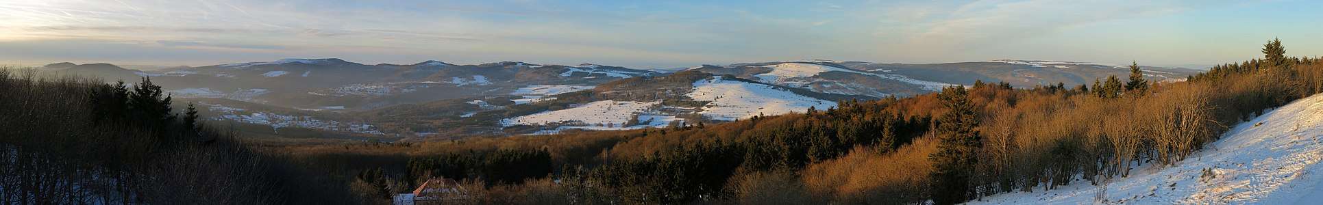 View fromt the Kreuzberg northward to the Dammersfeld Ridge with Kleiner- and Großer Auersberg, Dammersfeldkuppe, Eierhauckberg and Himmeldunkberg.
References
- ↑ Brigitte Schwenzer: Geographische Landesaufnahme: Die naturräumlichen Einheiten auf Blatt 140 Schweinfurt - Bundesanstalt für Landeskunde, Bad Godesberg 1968 → Online-Karte (PDF, 4 MB)
This article is issued from
Wikipedia.
The text is licensed under Creative Commons - Attribution - Sharealike.
Additional terms may apply for the media files.