Großer Auersberg
| Großer Auersberg | |
|---|---|
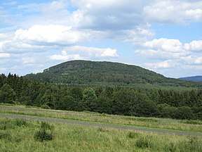 The Großer Auersberg from the southwest
 | |
| Highest point | |
| Elevation | 808.6 m above sea level (NN) (2,653 ft) |
| Coordinates | 50°22′03″N 9°52′18″E / 50.367474°N 9.871731°ECoordinates: 50°22′03″N 9°52′18″E / 50.367474°N 9.871731°E |
| Geography | |
 Großer Auersberg | |
| Parent range | Rhön |
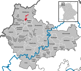
The Großer Auersberg is a mountain, 808.6 m above sea level (NN), in the Bavarian part of the Rhön mountains. It is located in an unparished area, 4.68 km² in area, in the county of Bad Kissingen, three kilometres southwest of the village centre of Wildflecken. The Großer Auersberg is covered by dense deciduous forest and lies within the Wildflecken Training Area, established in 1938. The entire terrain is a military out-of-bounds area, which civilians may not enter. A good two kilometres to the west-southwest rises the slightly less high Kleiner Auersberg. Neither should be confused with the Auersberg near Hilders in the Hessian part of the Rhön.
See also
References
This article is issued from
Wikipedia.
The text is licensed under Creative Commons - Attribution - Sharealike.
Additional terms may apply for the media files.