Dalbandin
| Dalbandin دالبندین | |
|---|---|
 Dalbandin 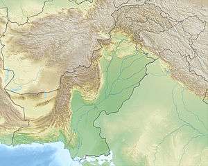 Dalbandin | |
| Coordinates: 28°53′39.26″N 64°23′54.94″E / 28.8942389°N 64.3985944°ECoordinates: 28°53′39.26″N 64°23′54.94″E / 28.8942389°N 64.3985944°E | |
| Country |
|
| Province | Balochistan |
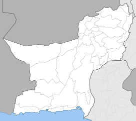
| District | Chagai |
| Government | |
| Elevation | 843 m (2,766 ft) |
| Population | |
| • Total | 16,319 |
| Time zone | UTC+5 (PST) |
| Calling code | 0825 |
| Highways |
|
Dalbandin (Balochi:دالبندین) is a city in District Chaghi, Baluchistan, Pakistan near the Iran and Afghanistan borders. It has a population of 16319, and the remainder of the entire Dalbandin Tehsil has a population of 110503.[1] It is located at an altitude of 843 m (2769 ft).[2] Dalbandin is famous for fruit orchards and for more other.
Climate
Dalbandin has a hot desert climate (Köppen climate classification BWh) with extremely hot summers and mild winters. The climate is very dry, but some rain, even (wet) snow, does fall in the winter.
| Climate data for Dalbandin | |||||||||||||
|---|---|---|---|---|---|---|---|---|---|---|---|---|---|
| Month | Jan | Feb | Mar | Apr | May | Jun | Jul | Aug | Sep | Oct | Nov | Dec | Year |
| Record high °C (°F) | 29.1 (84.4) |
36.0 (96.8) |
37.6 (99.7) |
40.8 (105.4) |
45.6 (114.1) |
48.8 (119.8) |
51.4 (124.5) |
46.7 (116.1) |
44.6 (112.3) |
42.2 (108) |
34.2 (93.6) |
29.4 (84.9) |
51.4 (124.5) |
| Average high °C (°F) | 17.4 (63.3) |
20.0 (68) |
26.2 (79.2) |
32.5 (90.5) |
38.1 (100.6) |
42.2 (108) |
42.5 (108.5) |
41.2 (106.2) |
37.7 (99.9) |
32.1 (89.8) |
25.4 (77.7) |
19.5 (67.1) |
31.2 (88.2) |
| Daily mean °C (°F) | 9.3 (48.7) |
12.3 (54.1) |
18.1 (64.6) |
24.1 (75.4) |
29.2 (84.6) |
33.1 (91.6) |
34.2 (93.6) |
32.5 (90.5) |
27.7 (81.9) |
21.8 (71.2) |
15.6 (60.1) |
10.9 (51.6) |
22.4 (72.3) |
| Average low °C (°F) | 1.3 (34.3) |
4.6 (40.3) |
9.9 (49.8) |
15.8 (60.4) |
20.3 (68.5) |
23.9 (75) |
25.9 (78.6) |
23.7 (74.7) |
17.7 (63.9) |
11.5 (52.7) |
5.7 (42.3) |
2.3 (36.1) |
13.6 (56.4) |
| Record low °C (°F) | −11.1 (12) |
−8.5 (16.7) |
−2.8 (27) |
2.2 (36) |
7.0 (44.6) |
12.8 (55) |
17.8 (64) |
8.3 (46.9) |
7.0 (44.6) |
−1.0 (30.2) |
−8.0 (17.6) |
−12.2 (10) |
−12.2 (10) |
| Average precipitation mm (inches) | 16.1 (0.634) |
18.1 (0.713) |
18.6 (0.732) |
7.8 (0.307) |
2.2 (0.087) |
0.8 (0.031) |
3.9 (0.154) |
0.9 (0.035) |
0.4 (0.016) |
1.5 (0.059) |
2.5 (0.098) |
7.9 (0.311) |
80.7 (3.177) |
| Mean monthly sunshine hours | 244.5 | 238.8 | 254.4 | 282.4 | 325.6 | 331.2 | 317.9 | 315.8 | 309.6 | 317.9 | 291.5 | 256.5 | 3,486.1 |
| Source: NOAA (1961-1990)[3] | |||||||||||||
2011 Earthquake
The 7.2 Mw Dalbandin earthquake shook a remote region of Balochistan on 19 January 2011. The dip-slip shock had a maximum Mercalli intensity of VI (Strong), caused moderate damage, and left three dead and several injured.
Transportation
Dalbandin has an airport about 1 mile (or 2 km) southwest of the city center of Dalbandin.
2016 US drone strike
Taliban leader Mullah Akhtar Mansour was killed in a convoy next to the town by a U.S. drone strike on May 21, 2016.[4]
See also
References
- ↑ http://www.pbscensus.gov.pk/sites/default/files/bwpsr/balochistan/CHAGAI_BLOCKWISE.pdf
- ↑ "Location of Dalbandin - Falling Rain Genomics". Dawn.com. 19 January 2011.
- ↑ "Dalbandin Climate Normals 1961-1990". National Oceanic and Atmospheric Administration. Retrieved January 17, 2013.
- ↑ Crawford, Jamie. "Taliban leader Mullah Mansour likely killed in airstrike, U.S. officials say". CNN. Retrieved 22 May 2016.