Curtina
| Curtina | |
|---|---|
| Village | |
 Curtina Location in Uruguay | |
| Coordinates: 32°9′0″S 56°7′0″W / 32.15000°S 56.11667°WCoordinates: 32°9′0″S 56°7′0″W / 32.15000°S 56.11667°W | |
| Country |
|
| Department | Tacuarembó Department |
| Population (2011) | |
| • Total | 1,037 |
| Time zone | UTC -3 |
| Postal code | 45002 |
| Dial plan | +598 463 (+5 digits) |
Curtina is a village in the Tacuarembó Department of northern-central Uruguay.
Location and geography
The village is located on Route 5, about 53 kilometres (33 mi) south of the city of Tacuarembó. The Arroyo Malo passes by the south side of the town.
History
On 5 July 1907, the group of houses formerly known as "San Máximo" was elevated to the status of "Pueblo" (village) by the Act of Ley Nº 3.189. It was the head of the judicial section of "Arroyo Malo".[1]
Population
In 2011 Curtina had a population of 1,037.[2]
| Year | Population |
|---|---|
| 1908 | 3.666 |
| 1963 | 806 |
| 1975 | 732 |
| 1985 | 651 |
| 1996 | 843 |
| 2004 | 1,029 |
| 2011 | 1,037 |
Source: Instituto Nacional de Estadística de Uruguay[1]
Places of worship
The village has a church called Capilla Santa Teresita.
Notable people
- Numa Moraes, Musician
- Guillermo Castro Duré, Musician
References
- 1 2 "Statistics of urban localities (1908–2004) (see also as "San Máximo")" (PDF). INE. 2012. Retrieved 7 September 2012.
- ↑ "Censos 2011 Cuadros Tacuarembó". INE. 2012. Retrieved 25 August 2012.
External links
Capital: Tacuarembó | ||
| Towns and villages | 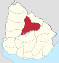 | |
| Sights | ||
This article is issued from
Wikipedia.
The text is licensed under Creative Commons - Attribution - Sharealike.
Additional terms may apply for the media files.