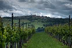
Cupramontana
| Cupramontana | ||
|---|---|---|
| Comune | ||
| Comune di Cupramontana | ||
 | ||
| ||
 Cupramontana Location of Cupramontana in Italy | ||
| Coordinates: 43°27′N 13°7′E / 43.450°N 13.117°E | ||
| Country | Italy | |
| Region | Marche | |
| Province | Ancona (AN) | |
| Frazioni | Poggio Cupro | |
| Government | ||
| • Mayor | Luigi Cerioni | |
| Area | ||
| • Total | 26.9 km2 (10.4 sq mi) | |
| Elevation | 505 m (1,657 ft) | |
| Population (30 June 2017) | ||
| • Total | 4,628 | |
| • Density | 170/km2 (450/sq mi) | |
| Demonym(s) | Cuprensi | |
| Time zone | UTC+1 (CET) | |
| • Summer (DST) | UTC+2 (CEST) | |
| Postal code | 60034 | |
| Dialing code | 0731 | |
| Website | Official website | |

Cupramontana is a comune (municipality) in the Province of Ancona in the Italian region Marche, located about 35 kilometres (22 mi) southwest of Ancona.
Cupramontana borders the following municipalities: Apiro, Maiolati Spontini, Mergo, Monte Roberto, Rosora, San Paolo di Jesi, Serra San Quirico, Staffolo. It takes its name from Cupra, a fertility goddess of the pre-Roman population of the Piceni.
External links
| Wikivoyage has a travel guide for Cupramontana. |

| Authority control |
|---|
This article is issued from
Wikipedia.
The text is licensed under Creative Commons - Attribution - Sharealike.
Additional terms may apply for the media files.