Crystal Springs, Arkansas
| Crystal Springs | |
|---|---|
| Unincorporated community | |
 Crystal Springs Crystal Springs's position in Arkansas.  Crystal Springs Crystal Springs (the US) | |
| Coordinates: 34°31′19″N 93°20′10″W / 34.52194°N 93.33611°WCoordinates: 34°31′19″N 93°20′10″W / 34.52194°N 93.33611°W | |
| Country |
|
| State |
|
| County | Garland |
| Elevation | 203 m (666 ft) |
| Time zone | UTC-6 (Central (CST)) |
| • Summer (DST) | UTC-5 (CDT) |
| GNIS feature ID | 76725 |
| U.S. Geological Survey Geographic Names Information System: Crystal Springs, Arkansas | |
Crystal Springs (also spelled Crystalsprings) is an unincorporated community in Garland County, Arkansas, United States.[1] On April 25, 2011, a tornado associated with the 2011 Super Outbreak hit the Crystal Springs area, destroying houses in nearby Sunshine.[2]
References
- ↑ "Feature Detail Report for: Crystal Springs, Arkansas." USGS. U.S. Geological Survey Geographic Names Information System: Crystal Springs, Arkansas Retrieved April 29, 2011.
- ↑ NOAA report
Municipalities and communities of Garland County, Arkansas, United States | ||
|---|---|---|
| Cities | 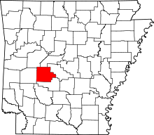 | |
| Towns | ||
| CDPs | ||
| Townships |
| |
| Other unincorporated communities | ||
| Footnotes | ‡This populated place also has portions in an adjacent county or counties | |
This article is issued from
Wikipedia.
The text is licensed under Creative Commons - Attribution - Sharealike.
Additional terms may apply for the media files.