Crum Creek
| Crum Creek | |
| River | |
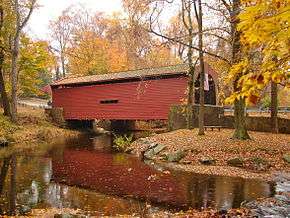 Bartram's Covered Bridge across Crum Creek | |
| Country | United States |
|---|---|
| State | Pennsylvania |
| Cities | Newtown Square, PA, Eddystone, PA |
| Source | |
| - coordinates | 40°02′15″N 75°28′34″W / 40.03750°N 75.47611°W |
| Mouth | Delaware River |
| - location | Eddystone, Delaware County, Pennsylvania, USA |
| - coordinates | 39°51′29″N 75°19′16″W / 39.85806°N 75.32111°WCoordinates: 39°51′29″N 75°19′16″W / 39.85806°N 75.32111°W |
| Length | 24 mi (39 km) |
Crum Creek (from the Dutch, meaning "crooked creek") is a creek in Delaware County and Chester County, Pennsylvania, flowing approximately 24 miles (39 km), generally in a southward direction and draining into the Delaware River in Eddystone, Pennsylvania.[1] It begins in a swamp (formerly a lake, dammed out) near Newtown Square, Pennsylvania along which several mills were established in the 19th century. Right afterward it crosses under Pennsylvania Route 29 and winds one and a half miles (2.4 km) downstream until it hits the hamlet of Crum Creek. It later flows into the Delaware River near Philadelphia.
Two notable landmarks along the creek's course are high trestles: a trolley trestle about 30 feet (9.1 m) high runs across the creek in Smedley Park, in Nether Providence Township; this trestle carries the Southeastern Pennsylvania Transportation Authority's 101 trolley line from Media, Pennsylvania across the creek. About a mile (1.6 km) south, a 1,000-foot-long (300 m), 100-foot-high (30 m) trestle carries SEPTA's Media/Elwyn Line commuter railroad line across the creek, which by now winds through a deep valley. The trestle is half in Nether Providence Township (west of the creek) and half in Swarthmore borough (east of the creek).
Baltimore Pike also crosses the Crum by Smedley Park in Nether Providence Township. A stone bridge carrying the highway was erected in 1924 with a 70-foot-tall (21 m) arch commemorating the 282 men and 2 women from Delaware County who died in World War I.[2] This arch was demolished in 1958 when the highway was widened. The memorial tablets were moved to the nearby entrance of Smedley Park.[3]
Crum Creek was dammed in 1931 near Pennsylvania Route 252 to fill Springton Lake (also known as Geist Reservoir), an approximately 391-acre (1.58 km2)[4] drinking water reservoir maintained by Aqua America.
Dams
Crum creek has five dams. Going north to south, the first is in Upper Providence Township, thus backing up the creek to create Springton Reservoir. The second is in Nether Providence Township at the Aqua PA facility, it creates a small, unnamed reservoir. The third is just north of Wallingford Road (Rogers Lane) partly in Springfield Township and partly in Nether Providence Township. The fourth is under the SEPTA Media/Elwyn bridge partly in Swarthmore and partly in Nether Providence. The fifth is just north of East Rosevalley Road (Yale Avenue) partly in Swarthmore and partly in Nether Providence.
See also
References
- ↑ Maccracken, Jim. Delaware County Fishing and Floating Guide Book. Lancaster, Ohio. Retrieved 5 November 2017.
- ↑ Photograph by PH.B.Wallace, July 1925, courtesy of Temple University Libraries, http://digital.library.temple.edu/u?/p15037coll5,104 accessed 01/11/10.
- ↑ http://www.delcohistory.org/nphs/nether_4.htm accessed 01/11/10
- ↑ Chester - Ridley - Crum Watersheds Association Archived 2008-10-16 at the Wayback Machine.