Crowley, Texas
| City of Crowley, Texas | |
|---|---|
| city | |
| Motto(s): "Governed by the People"[1] | |
 Location of Crowley in Tarrant County, Texas | |
| Coordinates: 32°34′37″N 97°21′35″W / 32.57694°N 97.35972°WCoordinates: 32°34′37″N 97°21′35″W / 32.57694°N 97.35972°W | |
| country | United States |
| State | Texas |
| counties | Tarrant, Johnson |
| Government | |
| • Type | council-manager |
| • City Council |
Mayor Billy Davis John Shotwell Jerry Beck Jesse Johnson Jim Hirth Tina Pace Christine Gilbreath |
| • City Manager | Robert Loftin |
| Elevation | 778 ft (237 m) |
| Population (2010) | |
| • Total | 12,838 |
| Time zone | UTC-6 (CST) |
| • Summer (DST) | UTC-5 (CDT) |
| zip code | 76036 |
| Area code(s) | 817 |
| GNIS feature ID | 1333742[2] |
| Website | www.ci.crowley.tx.us/ |
| FIPS code 48-17960; "American FactFinder". United States Census Bureau. Archived from the original on September 11, 2013. Retrieved 2008-01-31. | |
Crowley is a city located mainly in Tarrant County in the U.S. state of Texas. A tiny portion of the city (.01 sq mi) extends into Johnson County. The population was 12,838 at the 2010 census.[3]
History
Around 1848, pioneers began farming the area around Deer Creek.[4] The settlement moved a mile or so west to the site of present-day downtown Crowley when the Gulf, Colorado & Santa Fe Railroad built pens and laid tracks there. The first station depot was built in 1885. The community was named for S. H. Crowley, who was the master of transportation for the railroad.[5]
An election to approve the incorporation of Crowley was held on February 3, 1951. The town council voted to change the designation of Crowley from a town to a city on September 3, 1972.
Geography
According to the United States Census Bureau, the city has a total area of 7.3 square miles (18.8 km2), of which 0.01 square miles (0.03 km2), or 0.18%, is water.[6]
Crowley sits at the crossroads of Farm to Market Roads 1187 and 731, two miles west of Interstate 35W and 15 miles (24 km) south of downtown Fort Worth.
Demographics
| Historical population | |||
|---|---|---|---|
| Census | Pop. | %± | |
| 1960 | 583 | — | |
| 1970 | 2,662 | 356.6% | |
| 1980 | 5,852 | 119.8% | |
| 1990 | 6,974 | 19.2% | |
| 2000 | 7,467 | 7.1% | |
| 2010 | 12,838 | 71.9% | |
| Est. 2016 | 14,969 | [7] | 16.6% |
| U.S. Decennial Census[8] | |||
As of the 2010 census[9] there were 12,838 people, 4,408 households, and 3,424 families residing in the city. The population density was 1,769.5 people per square mile (683.2/km²). There were 4,714 housing units at an average density of 649.8 per square mile (250.9/km²).
| All Figures as of the Census of 2010 | ||
| Population | 12,838 | (density 1769.5/sq mi (683.2/km²)) |
| Households | 4,408 | (2.91 people per household) |
| Families | 3,424 | (3.29 people per family) |
| Housing Units | 4,714 | (average density: 649.8/sq mi (250.9/km²)) |
Racial makeup
The racial makeup of the city in 2010 was 76.5% White, 13.3% African American, 0.8% Native American, 1.5% Asian, 0.1% Pacific Islander, 4.8% from other races, and 3.1% from two or more races. Hispanic or Latino of any race were 15.2% of the population.
| White/Caucasian | 76.5% | (9,816 people) |
| Hispanic/Latino | 15.2% | (1,954 people) |
| Other races: | 4.8% | (616 people) |
| Two or more races | 3.1% | (399 people) |
| African American | 13.3% | (1,703 people) |
| Native American | 0.8% | (97 people) |
| Asian American | 1.5% | (197 people) |
| Pacific Islander | 0.1% | (10 people) |
Households
There were 4,408 households out of which 41.5% had children under the age of 18 living with them, 55.3% were married couples living together, 17.1% had a female householder with no husband present, and 22.3% were non-families. 17.6% of all households were made up of individuals and 5.6% had someone living alone who was 65 years of age or older. The average household size was 2.91 and the average family size was 3.29.
| Married Couples living together | 55.3% | (2,439 households) |
| Households with children under the age of 18 | 41.5% | (1,829 households) |
| Non-families | 22.3% | (984 households) |
| Households made up of individuals | 17.6% | (776 households) |
| Female householder with no husband present | 17.1% | (752 households) |
| Someone living alone who is 65 years of age or older | 5.6% | (247 households) |
Age
In the city of Crowley, the population distribution by age in 2010 was 30.9% under the age of 18, 8.6% from 18 to 24, 30.2% from 25 to 44, 22.0% from 45 to 64, and 8.3% who were 65 years of age or older. The median age was 31.9 years.
| Under 18 | 30.9% | (3,962 people) |
| 18 to 24 | 8.6% | (1,103 people) |
| 25 to 44 | 30.2% | (3,878 people) |
| 45 to 64 | 22.0% | (2,824 people) |
| 65 or older | 8.3% | (1,071 people) |
| Median Age | 31.9 years |
Sex
For every 100 females, there are 93.3 males. For every 100 females age 18 and over, there were 88.2 males.
| Male to Female Ratio | 100 females : 93.3 males |
| Male to Female Ratio (18 and over) | 100 females : 88.2 males |
Income
The median income for a household in the city was $65,419, and the median income for a family was $66,888. Males had a median income of $47,037 versus $34,294 for females. The per capita income for the city was $24,806.[10]
| Median Income (Household) | $65,419 |
| Median Income (Family) | $66,888 |
| Males | $47,037 |
| Females | $34,294 |
| Per capita (for each person) | $24,806 |
Poverty
About 6.3% of families and 7.9% of the population were below the poverty line, including 13.1% of those under age 18 and 1.3% of those age 65 or over.[10]
| Population Below Poverty Line | 7.9% | (1,014 people) |
| Families Below Poverty Line | 6.3% | (216 families) |
| % Poverty < 18 years old | 13.1% | (519 people) |
| % Poverty > 65 years old | 4.3% | (46 people) |
Education
The Crowley Independent School District extends north into Fort Worth and includes 22 public schools. Most of the district's schools are located within the Fort Worth city limits, including North Crowley High School and 9th Grade Campus, Crowley Middle School, Sue Crouch Intermediate School, and eight elementary schools. Crowley High School and 9th Grade Campus, H.F. Stevens Middle School, and two elementary schools are within the Crowley city limits.
Nazarene Christian Academy in Crowley serves students from kindergarten through 12th grade.[11]
Popular culture
- The computer game Dark Seed II takes place in Crowley. It is the hometown of the protagonist Mike Dawson, who suffered a nervous breakdown from the events of the previous game.
References
- ↑ "City of Crowley, Texas". City of Crowley, Texas. Retrieved August 16, 2012.
- ↑ "US Board on Geographic Names". United States Geological Survey. 2007-10-25. Retrieved 2008-01-31.
- ↑ "Profile of General Population and Housing Characteristics: 2010 Demographic Profile Data (DP-1): Crowley city, Texas". U.S. Census Bureau, American Factfinder. Archived from the original on September 11, 2013. Retrieved November 30, 2011.
- ↑ "Crowley, Texas". Texas State Historical Association. Retrieved August 16, 2012.
- ↑ "Profile for Crowley, Texas, TX". ePodunk. Retrieved August 16, 2012.
- ↑ "Geographic Identifiers: 2010 Demographic Profile Data (G001): Crowley city, Texas". U.S. Census Bureau, American Factfinder. Archived from the original on September 11, 2013. Retrieved November 30, 2011.
- ↑ "Population and Housing Unit Estimates". Retrieved June 9, 2017.
- ↑ "Census of Population and Housing". Census.gov. Archived from the original on May 12, 2015. Retrieved June 4, 2015.
- ↑ "American FactFinder". United States Census Bureau. Archived from the original on September 11, 2013. Retrieved 2008-01-31.
- 1 2 2008-2012 American Community Survey 5-Year Estimates
- ↑ "Nazarene Christian Academy". Retrieved December 11, 2015.
External links
- Crowley Area Chamber of Commerce
- Crowley ISD
- United States Census Bureau
- Texas State Historical Association
Municipalities and communities of Johnson County, Texas, United States | ||
|---|---|---|
| Cities | 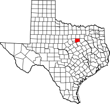 | |
| Towns | ||
| Unincorporated community | ||
| Footnotes | ‡This populated place also has portions in an adjacent county or counties | |
Municipalities and communities of Tarrant County, Texas, United States | ||
|---|---|---|
| Cities |
|  |
| Towns | ||
| CDPs | ||
| Unincorporated communities | ||
| Historical communities | ||
| Ghost towns | ||
| Footnotes | ‡ This populated place also has portions in an adjacent county or counties ‡‡ Previously considered a census-designated place | |