Couzon (Gier)
Coordinates: 45°31′49″N 4°37′30″E / 45.530283°N 4.625109°E
| Couzon | |
|---|---|
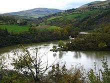 Couzon valley from the D30 between Rive-de-Gier and Sainte-Croix-en-Jarez, above the dam (November 2008) | |
| Country | France |
| Location | Rhône-Alpes |
| Physical characteristics | |
| Main source | Mont Pilat |
| River mouth | Rive-de-Gier |
| Length | 12.7 km (7.9 mi) |
| Basin features | |
| Progression | Gier→ Rhône→ Mediterranean Sea |
| Basin size | 34 km2 (13 sq mi) |
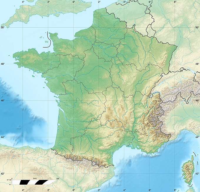
The Couzon is a river in the Loire department of France, a tributary of the Gier, which in turn is a tributary of the Rhône. A dam on the river, built to serve as a reservoir for the Givors canal, now provides drinking water to the town of Rive-de-Gier.
Geography
The Couzon drains a basin of 34 square kilometres (13 sq mi) at a mean altitude of 550 metres (1,800 ft). It rises in the Pilat massif at an altitude of about 900 metres (3,000 ft).[1] The river is 12.5 kilometres (7.8 mi) long. It runs through the communes of Pavezin, Sainte-Croix-en-Jarez, Châteauneuf and Rive-de-Gier. Tributaries are the Ruisseau Boissieux, Grand Valluy and Ruisseau de Chamerle.[2]
Dam
In December 1788 King Louis XVI of France approved construction of a reservoir to supply water to the Givors canal in dry periods. François Zacharie, the canal's builder, had proposed a site for the reservoir high up near Saint-Étienne, but the chosen site was low down on the Couzon near to Rive-de-Gier. This short-sighted decision ruled out the plan to continue the canal up to Saint-Etienne via the Janon and then down to the Loire.[3] The French Revolution (1789–1799) delayed the work, but construction of the Barrage de Couzon (Couzon Dam) was completed in 1811.[4] The dam was operational by 1812.[5] It was formally inaugurated on 23 September 1814 by the Comte d'Artois.[6]
The dam was modeled on the dam built at Saint-Ferriol for the Midi canal.[7] It has an unusual structure. Three parallel walls are interconnected by buttresses and form the central core.[6] This is 6.8 metres (22 ft) thick and 50 metres (160 ft) long. Earth banks on each side of the wall provide strength. On the upstream (reservoir) side the earth bank is 10 metres (33 ft) high, and on the downstream side the bank is 33 metres (108 ft) high.[8] Two tunnels run through the embankment at the deepest points. The lower one follows the original course of the river, and is used to remove silt from the reservoir. The upper one has valves where it exits the reservoir. There are two spillways with a combined length of 40 metres (130 ft).[9]
The dam intercepts water from a basin of 27.4 square kilometres (10.6 sq mi) with an average elevation of 588 metres (1,929 ft).[5] Initially the dam was capable of containing 1,000,000 cubic metres (35,000,000 cu ft) of water.[7] Today the dam has a capacity of 1,450,000 cubic metres (51,000,000 cu ft).[8] In 1880, when the canal company went bankrupt, the dam was converted into a source of drinking water for the inhabitants of Rive-de-Gier.[6] It delivers 245 litres (54 imp gal; 65 US gal) per second of water.[5] The water serves 95% of the municipality of Rive-de-Gier, part of Châteauneuf, and since 2005 St-Martin-le-Plain and St. Joseph. As of 2010 19,678 people relied on the dam for water, as well as various industrial users such as Industeel.[10]
Other uses
A stretch of 3 kilometres (1.9 mi) below the dam is used for kayaking.[11]
Gallery
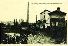 Route de Couzon in Rive-de-Gier start of the 20th century
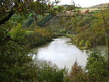 Reservoir of the Couzon dam in November 2008
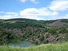 Country around the Couzon dam in August 2008
References
Citations
- ↑ CESAME 2010, p. 8.
- ↑ Le Couzon: sandre.
- ↑ Un canal oublié: La Tribune de Romain, p. 9.
- ↑ Smith 1972, p. 174.
- 1 2 3 CESAME 2010, p. 49.
- 1 2 3 Balades: Mairie de Chateauneuf.
- 1 2 Ravinet 1824, p. 116-116.
- 1 2 Balade en Pilat...
- ↑ Berlow 1998, p. 41.
- ↑ CESAME 2010, p. 50.
- ↑ Le Couzon: eauxvives.
Sources
- "Balade en Pilat, dans la vallée du Couzon". Forez Info. Retrieved 2013-08-30.
- "Balades". Mairie de Chateauneuf. Retrieved 2013-08-30.
- Berlow, Lawrence H. (1998). The Reference Guide to Famous Engineering Landmarks of the World: Bridges, Tunnels, Dams, Roads, and Other Structures. Oryx. ISBN 978-0-89774-966-4. Retrieved 2013-08-30.
- CESAME (March 2010). "Prélèvements et gestion quantitative de la ressource sur le bassin versant du Gier Phase 1" (PDF). Saint-Etienne Metropole. Retrieved 2012-08-20.
- "Le Couzon". eauxvives. Retrieved 2013-08-30.
- "Le Couzon". sandre. Retrieved 2013-08-30.
- Ravinet, Théodore (1824). Dictionnaire hydrographique de la France, contenant la description des rivières et canaux flottables et navigables dépendans du domaine public...: suivi de la collection complète des tarifs des droits de navigation (in French). Bachelier. Retrieved 2013-08-25.
- Smith, Norman Alfred Fisher (1972). A History of Dams. Citadel Press. ISBN 978-0-8065-0291-5. Retrieved 2013-08-30.
- "Un canal oublié" (PDF). La Tribune de Romain (in French). October 2012. Retrieved 2013-08-26.