County of Pelham
| Pelham Queensland | |||||||||||||||
|---|---|---|---|---|---|---|---|---|---|---|---|---|---|---|---|
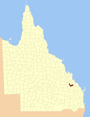 Location within Queensland | |||||||||||||||
| |||||||||||||||
The County of Pelham is a county (a cadastral division) in Queensland, Australia, located in the Shire of Banana in Central Queensland.[1][2] The county was created on 1 September 1855 by royal proclamation under the Waste Lands Australia Act 1846.[3] On 7 March 1901, the Governor issued a proclamation legally dividing Queensland into counties under the Land Act 1897.[4] Its schedule described Pelham thus:
Bounded on the north by the county of Raglan; on the east by the counties of Clinton and Rawbelle; on the south by the county of Rawbelle and the southern watershed of Scoria and Prospect Creeks; and on the west by the eastern watershed of the Dawson River.
Parishes
Pelham is divided into parishes, as listed below:
| Parish | LGA | Coordinates | Towns |
|---|---|---|---|
| Clifford | Banana | 24°25′S 150°53′E / 24.417°S 150.883°E | |
| Coreen | Banana | 24°23′S 150°19′E / 24.383°S 150.317°E | |
| Grevillea | Banana | 24°39′S 150°47′E / 24.650°S 150.783°E | Lawgi |
| Greycliffe | Banana | 24°16′S 150°18′E / 24.267°S 150.300°E | Goovigen |
| Kariboe | Banana | 24°33′S 150°55′E / 24.550°S 150.917°E | |
| Kooingal | Banana | 24°31′S 150°27′E / 24.517°S 150.450°E | |
| Kroombit | Banana | 24°30′S 150°45′E / 24.500°S 150.750°E | |
| Prospect | Banana | 24°40′S 150°35′E / 24.667°S 150.583°E | |
| Scoria | Banana | 24°35′S 150°37′E / 24.583°S 150.617°E | |
| Tiamby | Banana | 24°40′S 150°28′E / 24.667°S 150.467°E |
References
- ↑ "Pelham (entry 26314)". Queensland Place Names. Queensland Government. Retrieved 8 September 2015.
- ↑ Port Curtis District, County of Pelham Maps - F9 Series at Queensland Archives.
- ↑ "Proclamation". New South Wales Government Gazette. 29 June 1855. p. 1855:1737–1738.
- ↑ "A Proclamation". Queensland Government Gazette. 75. 8 March 1901. pp. 967–980.
Coordinates: 24°31′S 150°35′E / 24.517°S 150.583°E