Fier County
| Fier County Qarku Fier | ||
|---|---|---|
| County | ||
 Fier from the air | ||
| ||
 | ||
| Coordinates: 40°45′N 19°35′E / 40.75°N 19.58°E | ||
| Country |
| |
| Municipality(s) | 6 | |
| Villages | 275 | |
| Seat | Fier | |
| Government | ||
| • Council chairman | Vangjel Ndreka | |
| Area | ||
| • Total | 1,890 km2 (730 sq mi) | |
| Population (2016) | ||
| • Total | 312,448[1] | |
| Time zone | UTC+1 (CET) | |
| • Summer (DST) | UTC+2 (CEST) | |
| NUTS Code | AL032 | |
| Website | Official Website | |

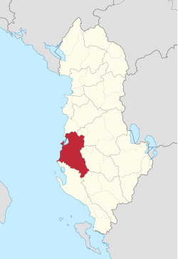
Fier County is a county located in southwestern Albania. The Fier County borders the Tirana County in the north, Elbasan County in the northeast, Berat County in the east, Gjirokastër County in the southeast, Vlorë County in the south and the Adriatic Sea in the west.
Geography
Administrative divisions
Until 2000, Fier County was subdivided into three districts: Fier, Lushnjë, and Mallakastër. Since the 2015 local government reform, the county consists of the following 6 municipalities: Divjakë, Fier, Lushnjë, Mallakastër, Patos and Roskovec.[2] Before 2015, it consisted of the following 42 municipalities:
- Allkaj
- Aranitas
- Ballagat
- Ballsh
- Bubullimë
- Cakran
- Dërmenas
- Divjakë
- Dushk
- Fier
- Fier-Shegan
- Frakull
- Fratar
- Golem
- Grabian
- Gradishtë
- Greshicë
- Hekal
- Hysgjokaj
- Karbunarë
- Kolonjë
- Krutje
- Kuman
- Kurjan
- Kutë
- Levan
- Libofshë
- Lushnjë
- Mbrostar
- Ngraçan
- Patos
- Portëz
- Qendër, Fier
- Qendër Dukas
- Roskovec
- Remas
- Ruzhdie
- Selitë
- Strum
- Tërbuf
- Topojë
- Zharrëz
The municipalities consist of about 275 towns and villages in total. See Villages of Fier County for a structured list.
Demographics
According to the last national census from 2011 this county has 310,331 inhabitants. Ethnic groups in the county include:[3]
- Albanians = 241,163 (77.71%)
- Greeks = 332 (0.11%)
- Macedonians = 18 (0.01%)
- Montenegrins = 5 (0.00%)
- Aromanians = 1,553 (0.50%)
- Romani = 1,640 (0,53%)
- Egyptians = 75 (0,02%)
- others = 171 (0.06%)
- no answer = 65,374 (21.07%)
References
- ↑ "Popullsia e Shqipërisë" (PDF). instat.gov.al (in Albanian). 19 February 2016. Archived from the original (PDF) on 12 April 2016. Retrieved 19 February 2016.
- ↑ Law nr. 115/2014
- ↑ "2011 census results" (PDF). Archived from the original (PDF) on 2016-03-04. Retrieved 2015-05-25.
External links
Counties in Albania are administrative divisions made up of municipalities and local administrative units. | ||
| Northern Albania | ||
| Central Albania | ||
| Southern Albania | ||
Administrative Divisions of Fier County | ||
|---|---|---|
County Seat: Fier | ||
| Municipality of Divjakë |  | |
| Municipality of Fier | ||
| Municipality of Lushnjë | ||
| Municipality of Mallakastër | ||
| Municipality of Patos | ||
| Municipality of Roskovec | ||