County Route 11 (Suffolk County, New York)
| ||||
|---|---|---|---|---|
| Pulaski Road | ||||
_Map.svg.png) Map of Suffolk County on Long Island with CR 11 highlighted in red | ||||
| Route information | ||||
| Maintained by SCDPW | ||||
| Length | 11.21 mi[1] (18.04 km) | |||
| Existed | January 27, 1930[2] – present | |||
| Major junctions | ||||
| West end |
| |||
|
| ||||
| East end |
| |||
| Highway system | ||||
| ||||

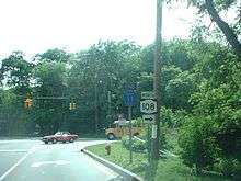
County Route 11 (CR 11), mostly known as Pulaski Road, is a county road in northwestern Suffolk County, New York, in the United States. It runs west to east between New York State Route 108 in Cold Spring Harbor and New York State Route 25A in Kings Park. Most of the road is two lanes wide, although there are some areas where it opens up to four lanes, or simply allows center-left-turn lanes.
Within northwestern Suffolk County, CR 11 provides the closest access to the Port Jefferson Branch of the Long Island Rail Road, since it runs roughly parallel to the tracks throughout its span.
Route description
CR 11 begins an intersection with NY 108 just east of the Nassau–Suffolk county line. In Nassau County, the road is Woodbury Road and designated ( but unsigned) as CR 12. CR 11 interrupts Woodbury Road, rather than replaces it. Shortly after this intersection, Woodbury Road moves north towards Huntington, while Pulaski Road, part of New York State Bicycle Route 25A (NYS Bike Route 25A), treks eastward.
In Huntington Manor CR 11 intersects with CR 92 where NYS Bike Route 25A turns south. It then crosses the Port Jefferson Branch of the Long Island Rail Road at an at-grade crossing before reaching the intersection of NY 110 in Huntington Station. Also in Huntington Station is the intersection of CR 35, which has become a connection between the North Shore and NY 231, since the cancellation of the proposed Babylon–Northport Expressway.
East of this point, much of the road is dotted with town houses and condominiums built along frontage roads. In Greenlawn, the road intersects with unsigned CR 9 (Cuba Hill Road), and signed CR 86 (Broadway–Greenlawn Centerport Road). Greenlawn Park is a local baseball field that runs along all three streets, and no others. In East Northport the road winds left near Oswego Drive, where the formerly proposed Babylon–Northport Expressway was intended to have an interchange. From there, Pulaski Road intersects CR 10 (Elwood Road) and then after Larkfield Road.
Crossing over the Port Jefferson Branch of the Long Island Rail Road a second time, Pulaski Road takes a steep drop down a hill far below the level of the tracks, where it encounters the intersection of Bread and Cheese Hollow Road. After, Pulaski Road leaves the Town of Huntington and enters the Town of Smithtown.
Sunken Meadow State Parkway was built underneath Pulaski Road in the 1950s. It shares a cloverleaf interchange, which has the southernmost ramps squeezed tightly between the train trestle carrying the LIRR Port Jefferson line. From there on, the name of the road is immediately changed to East Northport Road. NYS Bike Route 25A rejoins CR 11 at Old Commack Road, and CR 11 ends at NY 25A just two blocks west of Church Street. Northeast of CR 11's terminus at NY 25A, the road turns into Old Dock Road and runs along the west side of the former Kings Park State Hospital until reaching the Nissequogue River.
History
CR 11 was assigned on January 27, 1930.[2] Prior to 1961, Pulaski Road had suffixed sections of CR 11 that were intended to be integrated into the rest of the road, many of which were at disjointed intersections. Once the intersections were fixed, the suffixes were deleted.
- CR 11A: assigned to Pulaski Road between CR 86 and CR 10 from January 26, 1931 to September 21, 1966[2][3]
- CR 11B: assigned to Pulaski Road between NY 110 and CR 86 from December 28, 1931 to September 21, 1966[2][3]
- CR 11C: assigned to Pulaski Road between NY 108 and NY 110 from November 27, 1933 to September 21, 1966[2][3]
From the 1940s through the 1960s, the New York State Department of Transportation considered acquiring the road as part of a proposed North Shore Expressway which was to include the realignment of NY 25A.[4][5] It was thwarted by public opposition in the 1970s.
Major intersections
The entire route is in Suffolk County.
| Location | mi[1] | km | Destinations | Notes | |
|---|---|---|---|---|---|
| Cold Spring Harbor | 0.00 | 0.00 | Southern terminus of NY 108. Woodbury Road westbound goes into Nassau County | ||
| Huntington Station | 1.45 | 2.33 | |||
| 2.48 | 3.99 | Access to Huntington Railroad station | |||
| 3.73 | 6.00 | ||||
| Greenlawn | 5.02 | 8.08 | CR 9 is unsigned. | ||
| 5.24 | 8.43 | Access to Greenlawn Railroad Station | |||
| East Northport | 6.82 | 10.98 | |||
| 7.55 | 12.15 | Larkfield Road | Access to Northport Train Station. | ||
| Fort Salonga | 9.58 | 15.42 | Townline Road – Commack | Access to CR 4 via southbound Townline Road. | |
| Kings Park | 10.44 | 16.80 | Exit SM4 on Sunken Meadow Parkway. Access to Sunken Meadow State Park via Sunken Meadow State Parkway northbound. | ||
| 11.21 | 18.04 | Access to Kings Park Train Station via NY 25A eastbound. Old Dock Road continues eastbound towards the former Kings Park Psychiatric Center. | |||
| 1.000 mi = 1.609 km; 1.000 km = 0.621 mi | |||||
See also
.svg.png)
References
- 1 2 Template:NYSDOT Local Highway Inventory
- 1 2 3 4 5 "County Road System – County of Suffolk, New York" (PDF). Suffolk County Department of Public Works. December 29, 2005. Retrieved April 1, 2010.
- 1 2 3 Anderson, Steve. "Suffolk County Routes 1–25". NYCRoads. Archived from the original on February 21, 2012. Retrieved January 26, 2012.
- ↑ Anderson, Steve. "Astoria Expressway". NYCRoads. Retrieved January 26, 2012.
- ↑ Anderson, Steve. "North Shore Expressway (NY 347)". NYCRoads. "Mid-Suffolk To Queens Super 347?". Retrieved January 26, 2012.
General references
- Regional Plan Association News (May 1964);
- Arterial Progress (1959-1965), Triborough Bridge and Tunnel Authority (1965);
- "L.I. Road Parley Due" (Special to The New York Times; Sunday January 16, 1966; Page 50 L)
- "Travel Corridor Proposed on Long Island" by Francis X. Clines, The New York Times (May 28, 1967);
External links
| Wikimedia Commons has media related to County Route 11 (Suffolk County, New York). |