County Line, Wisconsin
| County Line, Wisconsin | |
|---|---|
| Unincorporated community | |
 County Line, Wisconsin  County Line, Wisconsin | |
| Coordinates: 44°59′25″N 87°51′09″W / 44.99028°N 87.85250°WCoordinates: 44°59′25″N 87°51′09″W / 44.99028°N 87.85250°W | |
| Country | United States |
| State | Wisconsin |
| Counties | Marinette and Oconto |
| Elevation | 623 ft (190 m) |
| Time zone | UTC-6 (Central (CST)) |
| • Summer (DST) | UTC-5 (CDT) |
| Area code(s) | 715 & 534 |
| GNIS feature ID | 1563451[1] |
County Line is an unincorporated community located on the border of Marinette and Oconto counties, in the U.S. state of Wisconsin.[1] The Marinette County portion of the community is located in the town of Grover, while the Oconto County portion is located in the town of Little River. County Line is located on County Trunk Highway W near U.S. Highway 41, 6.5 miles (10.5 km) southwest of Peshtigo.[2][3]
References
- 1 2 "County Line". Geographic Names Information System. United States Geological Survey. Retrieved August 9, 2011.
- ↑ Marinette County (PDF) (Map). 1:100,000. Cartography by WisDOT. Wisconsin Department of Transportation. T29N R22W S8. Archived from the original (PDF) on June 14, 2011. Retrieved August 9, 2011.
- ↑ Oconto County (PDF) (Map). 1:100,000. Cartography by WisDOT. Wisconsin Department of Transportation. T29N R22W S17. Archived from the original (PDF) on January 30, 2012. Retrieved August 9, 2011.
Municipalities and communities of Marinette County, Wisconsin, United States | ||
|---|---|---|
| Cities | 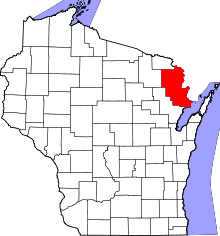 | |
| Villages | ||
| Towns | ||
| CDPs | ||
| Unincorporated communities | ||
| Footnotes | ‡This populated place also has portions in an adjacent county or counties | |
Municipalities and communities of Oconto County, Wisconsin, United States | ||
|---|---|---|
| Cities | 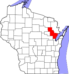 | |
| Villages | ||
| Towns | ||
| CDPs | ||
| Unincorporated communities | ||
| Indian reservation | ||
| Ghost town/neighborhood |
| |
| Footnotes | ‡This populated place also has portions in an adjacent county or counties | |
This article is issued from
Wikipedia.
The text is licensed under Creative Commons - Attribution - Sharealike.
Additional terms may apply for the media files.