Coudekerque-Village
| Coudekerque-Village Koudekerke-Dorp, Koukerke (West Flemish) | |
|---|---|
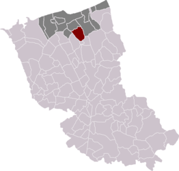 Location of Coudekerque-Village in the arrondissement of Dunkirk | |
 Coudekerque-Village Location within Hauts-de-France region  Coudekerque-Village | |
| Coordinates: 50°59′42″N 2°25′01″E / 50.995°N 2.417°ECoordinates: 50°59′42″N 2°25′01″E / 50.995°N 2.417°E | |
| Country | France |
| Region | Hauts-de-France |
| Department | Nord |
| Arrondissement | Dunkirk |
| Canton | Coudekerque-Branche |
| Intercommunality | Dunkerque grand littoral |
| Government | |
| • Mayor (2001–2008) | Jean-Marie Vandenbroucke |
| Area1 | 12.03 km2 (4.64 sq mi) |
| Population (2013)2 | 1,250 |
| • Density | 100/km2 (270/sq mi) |
| Time zone | UTC+1 (CET) |
| • Summer (DST) | UTC+2 (CEST) |
| INSEE/Postal code | 59154 /59380 |
| Elevation |
0–13 m (0–43 ft) (avg. 1 m or 3.3 ft) |
|
1 French Land Register data, which excludes lakes, ponds, glaciers > 1 km2 (0.386 sq mi or 247 acres) and river estuaries. 2 Population without double counting: residents of multiple communes (e.g., students and military personnel) only counted once. | |
Coudekerque-Village (Dutch: Koudekerke-Dorp) is a former commune of the Nord department in northern France. On 1 January 2016, it was merged into the new commune Téteghem-Coudekerque-Village.[1] Prior to October 6, 2008, it was known as Coudekerque (Koudekerke). The name was changed to distinguish it from Coudekerque-Branche.
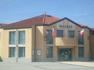
Town hall
Heraldry
_Nord-France.svg.png) |
The arms of Coudekerque-Village are blazoned : Argent, an eagle sable, langued gules. |
See also
References
- ↑ Arrêté préfectoral 30 November 2015 (in French)
| Wikimedia Commons has media related to Coudekerque-Village. |
This article is issued from
Wikipedia.
The text is licensed under Creative Commons - Attribution - Sharealike.
Additional terms may apply for the media files.