Cortland Township, DeKalb County, Illinois
| Cortland Township | |
|---|---|
| Township | |
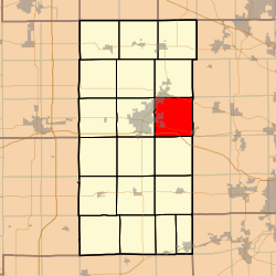 Location in DeKalb County | |
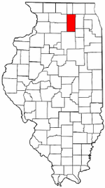 DeKalb County's location in Illinois | |
| Coordinates: 41°56′00″N 88°39′00″W / 41.93333°N 88.65000°WCoordinates: 41°56′00″N 88°39′00″W / 41.93333°N 88.65000°W | |
| Country |
|
| State |
|
| County | DeKalb |
| Established | February 1, 1865 |
| Area | |
| • Total | 35.3 sq mi (91 km2) |
| • Land | 35.08 sq mi (90.9 km2) |
| • Water | 0.21 sq mi (0.5 km2) 0.59% |
| Elevation | 850 ft (259 m) |
| Population (2010) | |
| • Estimate (2016)[1] | 11,145 |
| • Density | 312.6/sq mi (120.7/km2) |
| Time zone | UTC-6 (CST) |
| • Summer (DST) | UTC-5 (CDT) |
| ZIP codes | 60112, 60115, 60151, 60178 |
| FIPS code | 17-037-16483 |
Cortland Township is one of nineteen townships in DeKalb County, Illinois, USA. As of the 2010 census, its population was 10,968 and it contained 4,267 housing units.[2] Cortland Township was originally named Richland Township, but was renamed to Pampas Township on November 20, 1850; it was renamed to Cortland Township on February 1, 1865.
Geography
According to the 2010 census, the township has a total area of 35.3 square miles (91 km2), of which 35.08 square miles (90.9 km2) (or 99.38%) is land and 0.21 square miles (0.54 km2) (or 0.59%) is water.[2]
Cities, towns, villages
- Cortland
- Dekalb (east edge)
- Maple Park (partial)
- Sycamore (partial)
Cemeteries
The township contains these three cemeteries: Mound Rest, Mount Pleasant and Ohio Grove.
Airports and landing strips
- DeKalb Taylor Municipal Airport
- Ruder Airport
Demographics
| Historical population | |||
|---|---|---|---|
| Census | Pop. | %± | |
| Est. 2016 | 11,145 | [1] | |
| U.S. Decennial Census[3] | |||
School districts
- Dekalb Community Unit School District 428
- Kaneland Community Unit School District 302
- Sycamore Community Unit School District 427
Political districts
- Illinois's 14th congressional district
- State House District 70
- State Senate District 35
References
- "Cortland Township, DeKalb County, Illinois". Geographic Names Information System. United States Geological Survey. Retrieved 2010-07-04.
- United States Census Bureau 2009 TIGER/Line Shapefiles
- United States National Atlas
- 1 2 "Population and Housing Unit Estimates". Retrieved June 9, 2017.
- 1 2 "Population, Housing Units, Area, and Density: 2010 - County -- County Subdivision and Place -- 2010 Census Summary File 1". United States Census. Retrieved 2013-05-28.
- ↑ "Census of Population and Housing". Census.gov. Retrieved June 4, 2016.
External links
Places adjacent to Cortland Township, DeKalb County, Illinois | |
|---|---|
Municipalities and communities of DeKalb County, Illinois, United States | ||
|---|---|---|
| Cities | ||
| Town | ||
| Villages | ||
| Townships | ||
| Unincorporated communities | ||
| Ghost towns | ||
| Footnotes | ‡This populated place also has portions in an adjacent county or counties | |
This article is issued from
Wikipedia.
The text is licensed under Creative Commons - Attribution - Sharealike.
Additional terms may apply for the media files.