Corn Creek, South Dakota
| Corn Creek, South Dakota | |
|---|---|
| Unincorporated community | |
 Corn Creek, South Dakota  Corn Creek, South Dakota | |
| Coordinates: 43°33′54″N 101°12′04″W / 43.56500°N 101.20111°WCoordinates: 43°33′54″N 101°12′04″W / 43.56500°N 101.20111°W | |
| Country | United States |
| State | South Dakota |
| County | Mellette |
| Area[1] | |
| • Total | 2.103 sq mi (5.45 km2) |
| • Land | 2.040 sq mi (5.28 km2) |
| • Water | 0.063 sq mi (0.16 km2) |
| Elevation | 2,365 ft (721 m) |
| Population (2010)[1] | |
| • Total | 105 |
| • Density | 50/sq mi (19/km2) |
| Time zone | UTC-6 (Central (CST)) |
| • Summer (DST) | UTC-5 (CDT) |
| Area code(s) | 605 |
| GNIS feature ID | 1266592[2] |
Corn Creek is an unincorporated community and census-designated place in Mellette County, South Dakota, United States. Its population was 105 as of the 2010 census.[1] The community is located near the intersection of South Dakota Highway 44 and South Dakota Highway 63.
Geography
According to the U.S. Census Bureau, the community has an area of 2.103 square miles (5.45 km2); 2.040 square miles (5.28 km2) of its area is land, and 0.063 square miles (0.16 km2) is water.[1]
References
- 1 2 3 4 "2010 Census Gazetteer Files - Places: South Dakota". U.S. Census Bureau. Retrieved January 28, 2017.
- ↑ "Corn Creek". Geographic Names Information System. United States Geological Survey.
Municipalities and communities of Mellette County, South Dakota, United States | ||
|---|---|---|
| City | 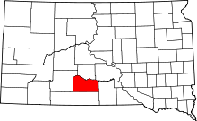 | |
| Town | ||
| CDPs | ||
| Unincorporated communities | ||
| Indian reservation | ||
| Ghost town | ||
| Footnotes | ‡This populated place also has portions in an adjacent county or counties | |
This article is issued from
Wikipedia.
The text is licensed under Creative Commons - Attribution - Sharealike.
Additional terms may apply for the media files.