Cook–Bateman Farm
|
Cook–Bateman Farm | |
 | |
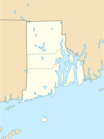  | |
| Location | Tiverton, Rhode Island |
|---|---|
| Coordinates | 41°33′16″N 71°12′15″W / 41.5545°N 71.2043°WCoordinates: 41°33′16″N 71°12′15″W / 41.5545°N 71.2043°W |
| Area | 63 acres (25 ha) |
| Built | 1730 |
| NRHP reference # | 79003775 [1] |
| Added to NRHP | October 11, 1979 |
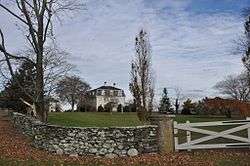
The Cook–Bateman Farm is a colonial farm at the corner of Fogland and Puncatest Neck Roads in Tiverton, Rhode Island. The oldest portion of the main farmhouse dates to c. 1730-48, was enlarged in c. 1812-20, and altered to give it then-fashionable Second Empire styling c. 1870. The farmhouse stands on 63 acres (25 ha) of rolling farmland, and is accompanied by a gambrel-roofed barn (late 19th or early 20th century) and a number of other smaller outbuildings. The property, which has evidence of Native American occupation, was developed by John Cook in the 18th century, and remained in the hands of just two families for more than 200 years.[2]
The farm was listed on the National Register of Historic Places in 1979.[1]
See also
References
- 1 2 National Park Service (2007-01-23). "National Register Information System". National Register of Historic Places. National Park Service.
- ↑ "NRHP nomination for Cook–Bateman Farm" (PDF). Rhode Island Preservation. Retrieved 2014-09-25.
| Topics | |
|---|---|
| Lists by states |
|
| Lists by insular areas | |
| Lists by associated states | |
| Other areas | |
| |
This article is issued from
Wikipedia.
The text is licensed under Creative Commons - Attribution - Sharealike.
Additional terms may apply for the media files.