Conway, Michigan
| Conway, Michigan | |
|---|---|
| Census-designated place | |
 Conway Location within the state of Michigan | |
| Coordinates: 45°25′1″N 84°51′55″W / 45.41694°N 84.86528°WCoordinates: 45°25′1″N 84°51′55″W / 45.41694°N 84.86528°W | |
| Country | United States |
| State | Michigan |
| County | Emmet |
| Townships | Little Traverse, Bear Creek |
| Area | |
| • Total | 0.4 sq mi (1.1 km2) |
| • Land | 0.4 sq mi (1.1 km2) |
| • Water | 0 sq mi (0 km2) |
| Elevation | 603.0 ft (183.8 m) |
| Population (2010) | |
| • Total | 204 |
| • Density | 484/sq mi (187.0/km2) |
| Time zone | UTC-5 (Eastern (EST)) |
| • Summer (DST) | UTC-4 (EDT) |
| ZIP code | 49722 |
| Area code(s) | 231 |
| FIPS code | 26-17900[1] |
| GNIS feature ID | 623717[2] |
Conway is an unincorporated community and census-designated place (CDP) in Emmet County, Michigan, United States. As of the 2010 census it had a population of 204.[1]
Geography
Conway is located in southeastern Emmet County, in southeastern Little Traverse Township. A portion of the CDP extends south into Bear Creek Township. The community is at the western end of Crooked Lake. U.S. Route 31 passes through the CDP, leading southwest 6 miles (10 km) to Petoskey, the county seat, and northeast 5 miles (8 km) to Alanson.
According to the U.S. Census Bureau, the Conway CDP has a total area of 0.42 square miles (1.1 km2), all of it land.[1]
References
- 1 2 3 "Geographic Identifiers: 2010 Demographic Profile Data (G001): Conway CDP, Michigan". U.S. Census Bureau, American Factfinder. Retrieved February 12, 2016.
- ↑ U.S. Geological Survey Geographic Names Information System: Conway, Michigan
Municipalities and communities of Emmet County, Michigan, United States | ||
|---|---|---|
| Cities | 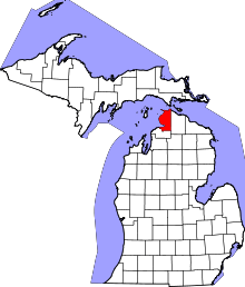 | |
| Villages | ||
| Townships | ||
| CDPs | ||
| Other unincorporated communities |
| |
| Indian reservation | ||
| Footnotes | ‡This populated place also has portions in an adjacent county or counties | |
This article is issued from
Wikipedia.
The text is licensed under Creative Commons - Attribution - Sharealike.
Additional terms may apply for the media files.