Conesville, Ohio
| Conesville, Ohio | |
|---|---|
| Village | |
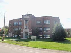 Conesville Elementary School | |
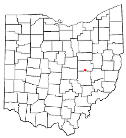 Location of Conesville, Ohio | |
 Location of Conesville in Coshocton County | |
| Coordinates: 40°11′2″N 81°53′31″W / 40.18389°N 81.89194°WCoordinates: 40°11′2″N 81°53′31″W / 40.18389°N 81.89194°W | |
| Country | United States |
| State | Ohio |
| County | Coshocton |
| Township | Franklin |
| Area[1] | |
| • Total | 0.16 sq mi (0.41 km2) |
| • Land | 0.16 sq mi (0.41 km2) |
| • Water | 0 sq mi (0 km2) |
| Elevation[2] | 745 ft (227 m) |
| Population (2010)[3] | |
| • Total | 347 |
| • Estimate (2012[4]) | 348 |
| • Density | 2,168.8/sq mi (837.4/km2) |
| Time zone | UTC-5 (Eastern (EST)) |
| • Summer (DST) | UTC-4 (EDT) |
| ZIP code | 43811 |
| Area code(s) | 740 |
| FIPS code | 39-18266[5] |
| GNIS feature ID | 1048625[2] |
Conesville is a village in Coshocton County, Ohio, United States, along the Muskingum River. The population was 347 at the 2010 census.
History
Conesville had its start when a man named Cones built a distillery there.[6]
The Conesville Power Plant is located just east of the village. Owned and operated by American Electric Power (AEP), the coal fired power plant started operations in 1957.[7]
Geography
Conesville is located at 40°11′2″N 81°53′31″W / 40.18389°N 81.89194°W (40.183753, -81.892019).[8]
According to the United States Census Bureau, the village has a total area of 0.16 square miles (0.41 km2), all land.[1]
Demographics
| Historical population | |||
|---|---|---|---|
| Census | Pop. | %± | |
| 1950 | 466 | — | |
| 1960 | 451 | −3.2% | |
| 1970 | 448 | −0.7% | |
| 1980 | 451 | 0.7% | |
| 1990 | 420 | −6.9% | |
| 2000 | 364 | −13.3% | |
| 2010 | 347 | −4.7% | |
| Est. 2017 | 342 | [9] | −1.4% |
| U.S. Decennial Census[10] | |||
2010 census
As of the census[3] of 2010, there were 347 people, 134 households, and 98 families residing in the village. The population density was 2,168.8 inhabitants per square mile (837.4/km2). There were 146 housing units at an average density of 912.5 per square mile (352.3/km2). The racial makeup of the village was 100.0% White.
There were 134 households of which 32.8% had children under the age of 18 living with them, 57.5% were married couples living together, 12.7% had a female householder with no husband present, 3.0% had a male householder with no wife present, and 26.9% were non-families. 21.6% of all households were made up of individuals and 13.4% had someone living alone who was 65 years of age or older. The average household size was 2.59 and the average family size was 2.98.
The median age in the village was 37.5 years. 25.6% of residents were under the age of 18; 6% were between the ages of 18 and 24; 28.2% were from 25 to 44; 22.2% were from 45 to 64; and 17.9% were 65 years of age or older. The gender makeup of the village was 46.7% male and 53.3% female.
2000 census
As of the census[5] of 2000, there were 364 people, 144 households, and 105 families residing in the village. The population density was 2,387.4 people per square mile (936.9/km²). There were 149 housing units at an average density of 977.3 per square mile (383.5/km²). The racial makeup of the village was 99.73% White, and 0.27% from two or more races. Hispanic or Latino of any race were 0.82% of the population.
There were 144 households out of which 32.6% had children under the age of 18 living with them, 57.6% were married couples living together, 13.2% had a female householder with no husband present, and 26.4% were non-families. 24.3% of all households were made up of individuals and 12.5% had someone living alone who was 65 years of age or older. The average household size was 2.53 and the average family size was 2.95.
In the village, the population was spread out with 25.8% under the age of 18, 9.9% from 18 to 24, 26.6% from 25 to 44, 25.0% from 45 to 64, and 12.6% who were 65 years of age or older. The median age was 35 years. For every 100 females there were 96.8 males. For every 100 females age 18 and over, there were 92.9 males.
The median income for a household in the village was $35,139, and the median income for a family was $46,563. Males had a median income of $29,444 versus $22,750 for females. The per capita income for the village was $18,015. About 6.7% of families and 10.0% of the population were below the poverty line, including 16.2% of those under age 18 and 12.1% of those age 65 or over.
References
- 1 2 "US Gazetteer files 2010". United States Census Bureau. Archived from the original on 2012-01-24. Retrieved 2013-01-06.
- 1 2 "US Board on Geographic Names". United States Geological Survey. 2007-10-25. Retrieved 2008-01-31.
- 1 2 "American FactFinder". United States Census Bureau. Retrieved 2013-01-06.
- ↑ "Population Estimates". United States Census Bureau. Archived from the original on 2013-06-17. Retrieved 2013-06-17.
- 1 2 "American FactFinder". United States Census Bureau. Archived from the original on 2013-09-11. Retrieved 2008-01-31.
- ↑ Graham, Albert Adams (1881). History of Coshocton County, Ohio: Its Past and Present, 1740-1881. A. A. Graham. p. 499.
- ↑ Hayhurst, Leonard (August 24, 2017). "AEP Conesville still fired up after 60 years". Coshocton Tribune. Retrieved June 18, 2018.
- ↑ "US Gazetteer files: 2010, 2000, and 1990". United States Census Bureau. 2011-02-12. Retrieved 2011-04-23.
- ↑ "Population and Housing Unit Estimates". Retrieved May 26, 2018.
- ↑ "Census of Population and Housing". Census.gov. Archived from the original on May 12, 2015. Retrieved June 4, 2015.
Municipalities and communities of Coshocton County, Ohio, United States | ||
|---|---|---|
| City | 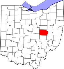 | |
| Villages | ||
| Townships | ||
| CDPs | ||
| Unincorporated communities |
| |
| Ghost towns | ||
| Footnotes | ‡This populated place also has portions in an adjacent county or counties | |