Burnside, Dunedin
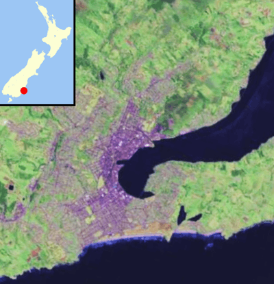
Burnside is a mainly industrial suburb of the New Zealand city of Dunedin. It is located at the mouth of a long valley, the Kaikorai Valley, through which flows the Kaikorai Stream. This valley stretches to the northeast for 3.5 kilometres (2.2 mi). Burnside is 5.5 kilometres (3.4 mi) to the southwest of the city centre, close to eastern end of the much larger suburb, Green Island. Other suburbs located nearby include Concord, immediately to the southeast and Kenmure further up Kaikorai Valley.
Burnside is separated from the central urban area of Dunedin by the large ridge which surrounds the city's heart. This ridge is part of the crater wall of the long-extinct Dunedin Volcano. The ridge lies immediately to the east of Burnside, with the main pass over it, the saddle of Lookout Point, lying 0.8 kilometres (0.50 mi) to the east.
Major industries
Kempthorne Prosser & Co's New Zealand Drug Company
Kempthorne Prosser's Burnside Chemical Works that made fertilisers from Sulphuric acid opened in 1880 and were the first of its kind in the colony. It closed in the early 1960s and was sold to Dominion Fertiliser before being demolished.
New Zealand Refrigerating Company
Burnside is the site of the former Burnside Freezing Works of New Zealand Refrigerating Company, the first works of its kind in New Zealand. This large complex has its origin in a plant opened in 1881,[1] and an abattoir continued to operate at this site until the late 1980s.
There are plans to turn the site into an industrial city.[2]
Otago Iron Rolling Mills
Previously Smellie Brothers' Iron Rolling Mills. The rolled metal was manufactured from scrap iron. Heated to a white-hot mass before being put under a steam hammer the metal was then rolled and converted to square, angle, flat, rolled and standard iron sold to wholesale merchants throughout the country.[3]
Other industries
A tannery, flour mill, and several fellmongeries.[3]
Another former landmark industry in the area was the Burnside Cement Factory, which also operated until the 1980s.
Among other industries in the area are numerous small manufacturing plants and wholesalers, and several car sales yards, all in lower Kaikorai Valley Road.
To its west and northwest Burnside is predominantly rural hillsides which contain one of the city's main reservoirs, the Southern Reservoir.
Burnside's location means that there are several major transport routes associated with it. A large motorway interchange lies in Burnside, with slip roads from the Dunedin Southern Motorway to Green Island and the Kaikorai Valley, as well as routes connecting the motorway and Kaikorai Valley with Concord and the southwestern hill suburb of Corstorphine. The South Island Main Trunk railway passes through Burnside (though there are no longer passenger stations in the suburb) entering a tunnel which runs beneath Lookout Point, emerging in Caversham, New Zealand.
Concord
The small residential suburb of Concord lies immediately to the southeast of Burnside. It lay on State Highway 1 until the construction of the Dunedin Southern Motorway in the 1990s, but is now bypassed by traffic from central Dunedin. The former Main South Road is now largely reduced to a narrow one-way street leading down from Lookout Point, virtually a long slip-road from the start of the motorway, though it is still two-way through Concord itself, and serves (along with Stevenson Road, which it becomes) as an important link road to Corstorphine and Calton Hill.
References
- ↑ Farming Hocken Bulletin 50, July 2005
- ↑ Harvey, Sarah (2 May 2009). "Plans for 'industrial city' at Burnside". Otago Daily Times. Retrieved 22 September 2011.
- 1 2 The Cyclopedia of New Zealand 1905