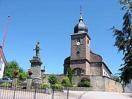
Colroy-la-Grande
| Colroy-la-Grande | ||
|---|---|---|
 | ||
| ||
 Colroy-la-Grande Location within Grand Est region  Colroy-la-Grande | ||
| Coordinates: 48°19′01″N 7°06′46″E / 48.3169°N 7.1128°ECoordinates: 48°19′01″N 7°06′46″E / 48.3169°N 7.1128°E | ||
| Country | France | |
| Region | Grand Est | |
| Department | Vosges | |
| Arrondissement | Saint-Dié-des-Vosges | |
| Canton | Provenchères-sur-Fave | |
| Intercommunality | Fave | |
| Government | ||
| • Mayor (2008–2014) | Georgette Blaise | |
| Area1 | 11.86 km2 (4.58 sq mi) | |
| Population (2006)2 | 592 | |
| • Density | 50/km2 (130/sq mi) | |
| Time zone | UTC+1 (CET) | |
| • Summer (DST) | UTC+2 (CEST) | |
| INSEE/Postal code | 88112 /88490 | |
| Elevation |
408–790 m (1,339–2,592 ft) (avg. 453 m or 1,486 ft) | |
|
1 French Land Register data, which excludes lakes, ponds, glaciers > 1 km2 (0.386 sq mi or 247 acres) and river estuaries. 2 Population without double counting: residents of multiple communes (e.g., students and military personnel) only counted once. | ||

Colroy-la-Grande is a former commune in the Vosges department in northeastern France. On 1 January 2016, it was merged into the new commune Provenchères-et-Colroy.[1]
See also
References
- ↑ Arrêté préfectoral 22 December 2015 (in French)
| Wikimedia Commons has media related to Colroy-la-Grande. |
This article is issued from
Wikipedia.
The text is licensed under Creative Commons - Attribution - Sharealike.
Additional terms may apply for the media files.