Colorado State Highway 291
| ||||
|---|---|---|---|---|
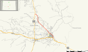 Map of Chaffee County in central Colorado with SH 291 highlighted in red | ||||
| Route information | ||||
| Maintained by CDOT | ||||
| Length | 9.135 mi[1] (14.701 km) | |||
| Location | ||||
| Counties | Chaffee | |||
| Highway system | ||||
|
Colorado State Highways
| ||||

State Highway 291 is a highway near Salida, Colorado.
Route description
SH 291 runs 9.1 miles (14.6 km), starting at a junction with US 50 in Salida. From US 50, it travels north as Oak St. It then turns northwest to become 1st St. as it passes through Salida's historic downtown, paralleling the Arkansas River. The highway continues northwest, crossing the Arkansas River twice and ending at a junction with US 285.[2]
Major intersections
The entire route is in Chaffee County.
| Location | mi | km | Destinations | Notes | |
|---|---|---|---|---|---|
| Salida | 0.000 | 0.000 | |||
| | 9.135 | 14.701 | |||
| 1.000 mi = 1.609 km; 1.000 km = 0.621 mi | |||||
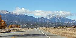
Highway 291 near where it ends at Highway 285.
References
- ↑ "Segment list for SH 291". Retrieved 2011-01-22.
- ↑ "Highway Explorer". CDOT OTIS - Online Transportation Information System. Colorado DOT. Retrieved 29 September 2017.
External links
This article is issued from
Wikipedia.
The text is licensed under Creative Commons - Attribution - Sharealike.
Additional terms may apply for the media files.