Colorado State Highway 266
| ||||
|---|---|---|---|---|
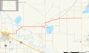 Map of Otero County in southeastern Colorado with SH 266 highlighted in red | ||||
| Route information | ||||
| Maintained by CDOT | ||||
| Length | 11.516 mi[1] (18.533 km) | |||
| Location | ||||
| Counties | Otero | |||
| Highway system | ||||
|
Colorado State Highways
| ||||

State Highway 266 is a highway near Rocky Ford, Colorado.
Route description
SH 266 runs 11.5 miles (18.5 km), starting at a junction with US 50 in Rocky Ford. The highway goes east, crosses the Arkansas River and ends at a junction with SH 109 near Cheraw.
Major intersections
The entire route is in Otero County.
| Location | mi | km | Destinations | Notes | |
|---|---|---|---|---|---|
| Rocky Ford | 0.000 | 0.000 | |||
| 0.060 | 0.097 | ||||
| | 11.516 | 18.533 | |||
| 1.000 mi = 1.609 km; 1.000 km = 0.621 mi | |||||
References
- ↑ "Segment list for SH 266". Retrieved 2011-01-22.
External links
This article is issued from
Wikipedia.
The text is licensed under Creative Commons - Attribution - Sharealike.
Additional terms may apply for the media files.