Colorado State Highway 265
| ||||
|---|---|---|---|---|
| Brighton Blvd. | ||||
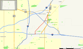 Map of north central Colorado with SH 265 highlighted in red | ||||
| Route information | ||||
| Maintained by CDOT | ||||
| Length | 3.621 mi[1] (5.827 km) | |||
| Location | ||||
| Counties | Adams, Denver | |||
| Highway system | ||||
|
Colorado State Highways
| ||||

State Highway 265 is a Colorado highway linking Denver and Commerce City.
Route description
SH 265 runs 3.6 miles (5.8 km), starting at a junction with I-70 in Denver. The highway goes northwest and ends at a junction with US 6 / US 85 in Commerce City.
Major intersections
| County | Location | mi | km | Destinations | Notes |
|---|---|---|---|---|---|
| City and County of Denver | 0.000 | 0.000 | |||
| Adams | Commerce City | 3.621 | 5.827 | ||
| 1.000 mi = 1.609 km; 1.000 km = 0.621 mi | |||||
References
- ↑ "Segment list for SH 265". Retrieved 2011-01-22.
External links
This article is issued from
Wikipedia.
The text is licensed under Creative Commons - Attribution - Sharealike.
Additional terms may apply for the media files.