Colorado State Highway 110
| ||||
|---|---|---|---|---|
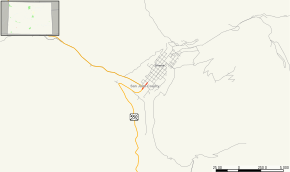 Map of San Juan County in southwestern Colorado with SH 110 highlighted in red | ||||
| Route information | ||||
| Maintained by CDOT | ||||
| Length | 0.186 mi[1] (0.299 km) | |||
| Major junctions | ||||
| West end |
| |||
| East end | CDOT maintenance yard | |||
| Location | ||||
| Counties | San Juan | |||
| Highway system | ||||
|
Colorado State Highways
| ||||

State Highway 110 (SH 110) was a state highway in Silverton, Colorado.
Route description
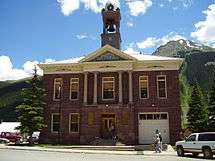
Silverton city hall
The route began at U.S. Highway 550 in Silverton and ran for 740 feet[1] to its terminus at a CDOT maintenance yard.
History
The route was established in the 1920s, when it began at U.S. Highway 550 in Silverton and headed north to Howardsville. SH 110 was extended north to Eureka by 1938. The northern terminus was moved to Gladstone in 1961. Except for 740 feet, the entire route was deleted north of Silverton in 2003. The remainder was deleted in 2007.[2]
Major intersections
The entire route is in Silverton, San Juan County.
| mi | km | Destinations | Notes | ||
|---|---|---|---|---|---|
| 0.000 | 0.000 | ||||
| 0.186 | 0.299 | CDOT maintenance yard | |||
| 1.000 mi = 1.609 km; 1.000 km = 0.621 mi | |||||
References
- 1 2 "Segment list for SH 110". Retrieved 2008-04-30.
- ↑ Salek, Matthew E. "Colorado Routes 110-119". Retrieved 2010-05-30.
External links
This article is issued from
Wikipedia.
The text is licensed under Creative Commons - Attribution - Sharealike.
Additional terms may apply for the media files.