Coleen River
| Coleen River | |
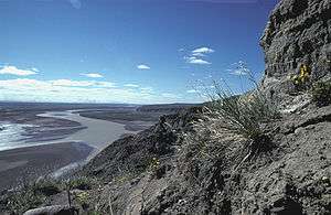 Coleen River in summer | |
| Country | United States |
|---|---|
| State | Alaska |
| Districts | North Slope Borough, Yukon–Koyukuk Census Area |
| Source | Brooks Range |
| - location | Arctic National Wildlife Refuge, North Slope Borough |
| - elevation | 4,798 ft (1,462 m) [1] |
| - coordinates | 68°42′59″N 143°28′36″W / 68.71639°N 143.47667°W [2] |
| Mouth | Porcupine River [2] |
| - location | 9 miles (14 km) east of Coleen Mountain, Yukon–Koyukuk Census Area |
| - coordinates | 67°04′20″N 142°29′49″W / 67.07222°N 142.49694°WCoordinates: 67°04′20″N 142°29′49″W / 67.07222°N 142.49694°W [2] |
| Length | 145 mi (233 km) [2] |
 Location of the mouth of the Coleen River in Alaska | |
The Coleen River is a 186-mile (299 km) tributary of the Porcupine River in the northeastern part of the U.S. state of Alaska. It begins in the Davidson Mountains in the Arctic National Wildlife Refuge and flows generally south-southeast into the larger river east of Coleen Mountain.[3] Its name comes from the French "coline", which means hill.
See also
References
- ↑ Derived by entering source coordinates in Google Earth.
- 1 2 3 4 "Coleen River". Geographic Names Information System. United States Geological Survey. March 31, 1981. Retrieved November 6, 2013.
- ↑ Alaska Atlas & Gazetteer (7th ed.). Yarmouth, Maine: DeLorme. 2010. p. 137. ISBN 978-0-89933-289-5.
External links
- "Coleen River Watershed -- 19040202". cfpub.epa.gov. Retrieved 2009-11-29.
This article is issued from
Wikipedia.
The text is licensed under Creative Commons - Attribution - Sharealike.
Additional terms may apply for the media files.