Coipasa Lake
| Lago Coipasa | |
|---|---|
 | |
| Location | Atahuallpa Province, Oruro Department |
| Coordinates | 19°12′S 68°07′W / 19.200°S 68.117°WCoordinates: 19°12′S 68°07′W / 19.200°S 68.117°W |
| Primary inflows | Río Lauca |
| Basin countries | Bolivia |
| Surface area | 806 km2 (311 sq mi) |
| Max. depth | 3.5 m (11 ft) |
| Surface elevation | 3,657 m (11,998 ft) |
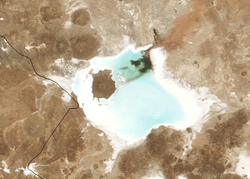
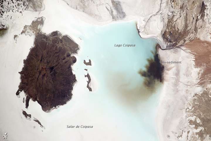
Lago Coipasa or Salar de Coipasa is a lake in Atahuallpa Province, Oruro Department, Bolivia. At an elevation of 3657 m, its surface area is 806 km². It's on the western part of Altiplano, 20 km north of Salar de Uyuni and south of the main road linking Oruro and Huara (Chile).[1]
Coipasa Lake is a tectonic saline lake with a depth of 3.5 metres that is surrounded by the Coipasa salt flats (Salar de Coipasa), and the volcanic cone of Wila Pukarani.
Thousands of flamingos have settled on the shores of Lake Coipasa.
See also
References
- ↑ "Travel map of the Andes". Nelles Map. Retrieved 2010-12-10.
External links

- Salar de Coipasa (Map). Archived from the original on 31 May 2014.
- www
.boliviatravelsite .com /attractions .php?attraction=Coipasa+Lake - gsabulletin
.gsapubs .org /content /118 /5-6 /515 .abstract
This article is issued from
Wikipedia.
The text is licensed under Creative Commons - Attribution - Sharealike.
Additional terms may apply for the media files.