Clyde River (Ontario)
| Clyde River | |
| River | |
| Name origin: After the River Clyde in Scotland | |
| Country | Canada |
|---|---|
| Province | Ontario |
| Region | Eastern Ontario |
| County | Lanark |
| Municipalities | Tay Valley, Drummond/North Elmsley, Lanark Highlands |
| Part of | Saint Lawrence River drainage basin |
| Tributaries | |
| - right | Little Clyde River, South Branch Clyde River, Middle Branch Clyde Creek |
| Source | Clyde Lake |
| - location | Lanark Highlands |
| - elevation | 196 m (643 ft) |
| - coordinates | 45°10′57″N 76°41′05″W / 45.18250°N 76.68472°W |
| Mouth | Mississippi River |
| - location | Tay Valley |
| - elevation | 146 m (479 ft) |
| - coordinates | 44°59′20″N 76°22′07″W / 44.9887697°N 76.3686252°WCoordinates: 44°59′20″N 76°22′07″W / 44.9887697°N 76.3686252°W |
 Location of the mouth of the Clyde River in southern Ontario | |
The Clyde River is a river in Lanark County in Eastern Ontario, Canada.[1] It is in the Saint Lawrence River drainage basin, is a left tributary of the Mississippi River, and was named after the River Clyde in Scotland.
Course
The Clyde flows south from its source at the outflow from Clyde Lake in geographic Lavant Township[2] in the municipality of Lanark Highlands to the community of Clyde Forks, where it takes in the right tributaries Middle Branch Clyde River and South Branch Clyde River. To this point, the river is paralleled by the K&P Rail Trail which follows the course of the former Kingston and Pembroke Railway. The river then heads east, then southeast into geographic Darling Township[3] then geographic Lanark Township,[4] takes in the right tributary Little Clyde River, and arrives at the community of Lanark. The river continues south passing briefly through geographic Drummond Township[5] in the municipality of Drummond/North Elmsley, then reaches its mouth at the Mississippi River in geographic Bathurst Township[6] in the municipality of Tay Valley, north of the town of Perth. The Mississippi River flows via the Ottawa River to the Saint Lawrence River.
Tributaries
- Middleville Creek (left)
- Hopetown Creek (right)
- Bennys Creek (left)
- Little Clyde River (right)
- Eastons Creek (right)
- Black Creek (right)
- Edmunds Creek (left)
- Pilons Creek (left)
- Lavant Creek (right)
- McCreas Creek (left)
- La France Creek (right)
- South Branch Clyde River (right)
- Middle Branch Clyde Creek (right)
- Clyde Lake
- Baldwin Depot Creek
References
- ↑ "Clyde River". Geographical Names Data Base. Natural Resources Canada. Retrieved 2014-01-28.
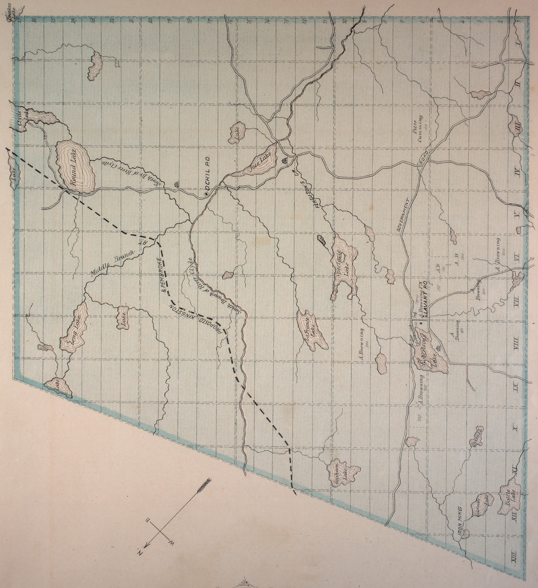
- ↑ "Township of Lavant" (JPG). Canadian County Atlas Project. McGill University. 2001. Retrieved 2014-01-28.
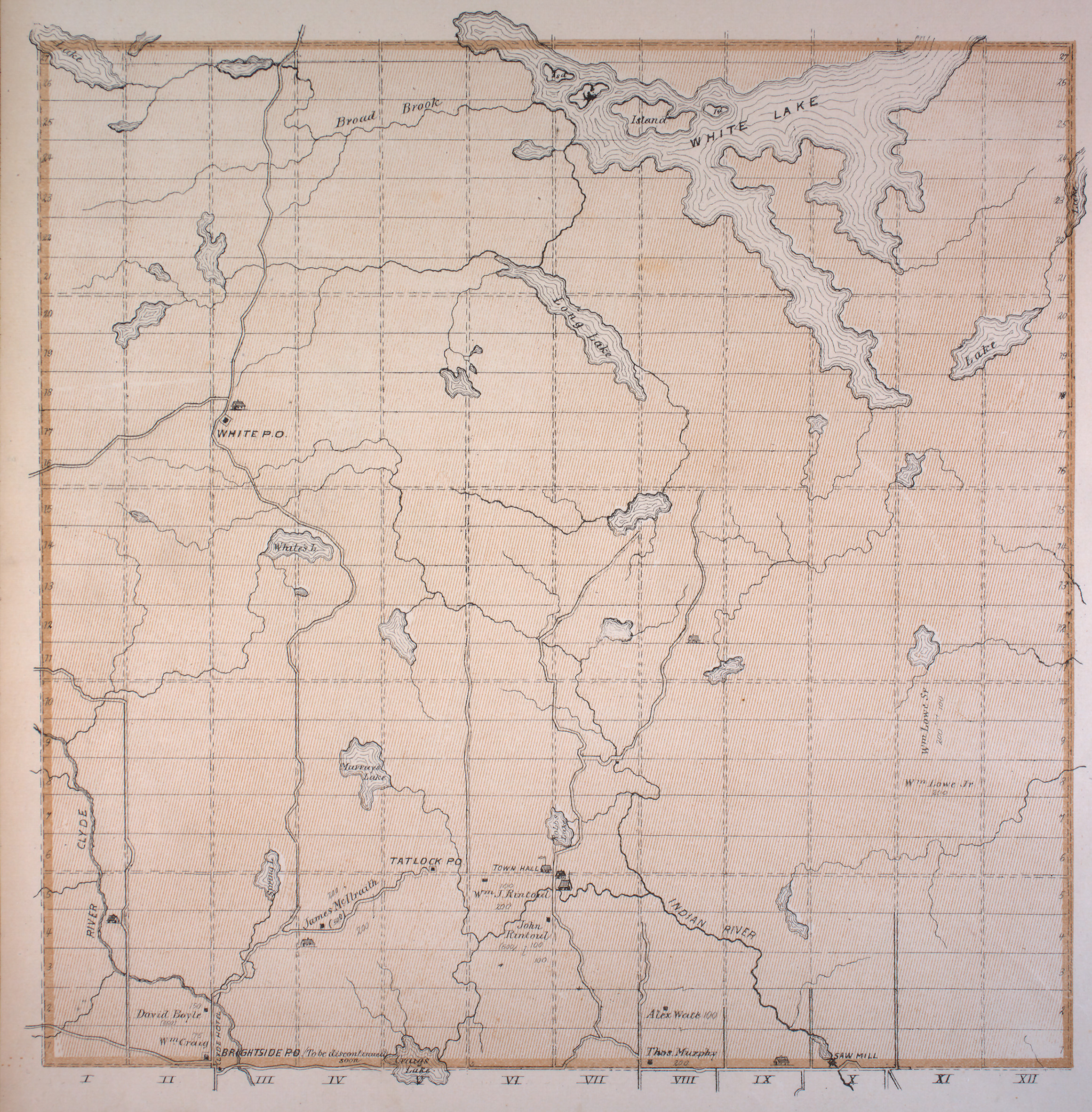
- ↑ "Township of Darling" (JPG). Canadian County Atlas Project. McGill University. 2001. Retrieved 2014-01-28.
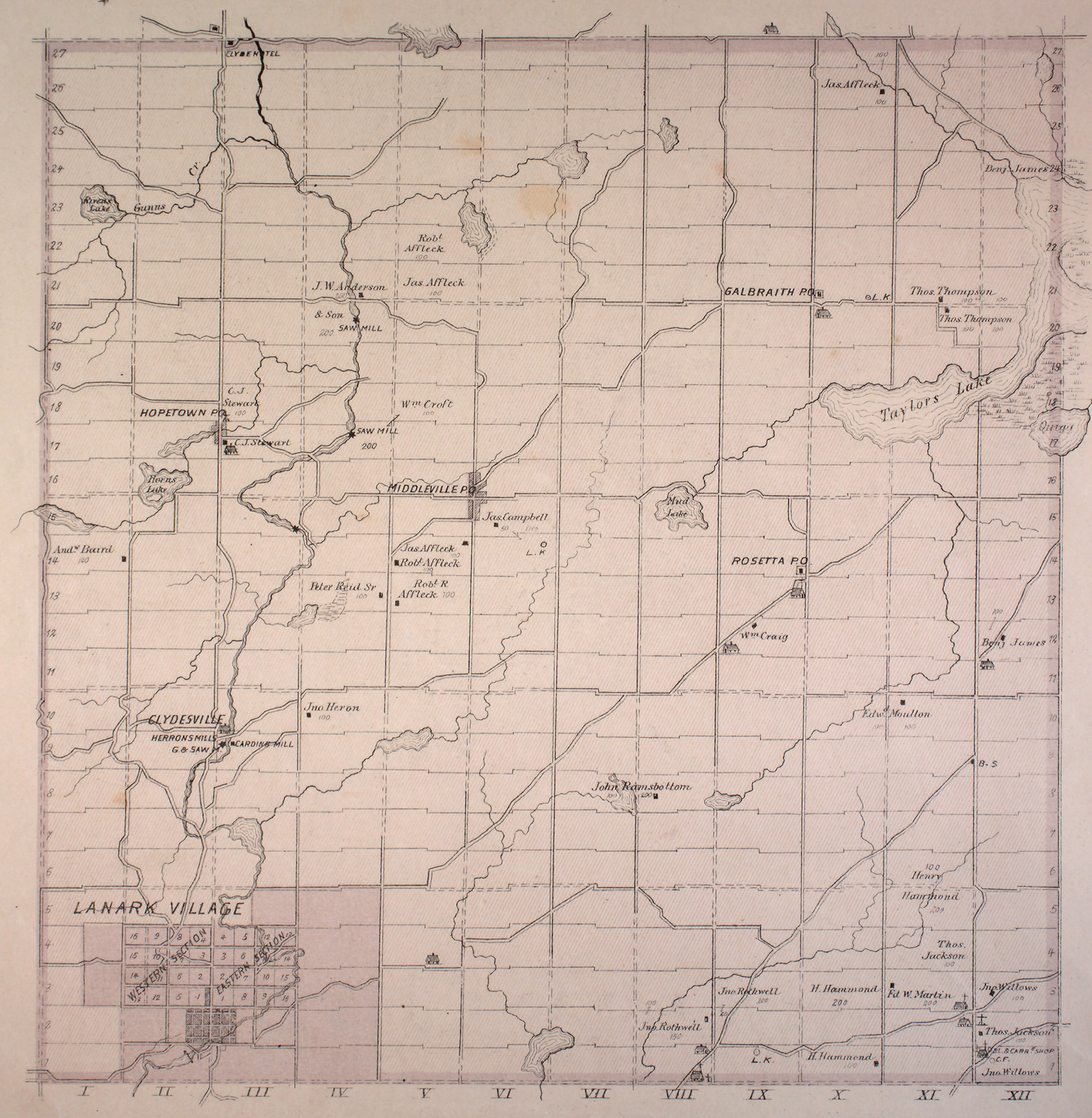
- ↑ "Township of Lanark" (JPG). Canadian County Atlas Project. McGill University. 2001. Retrieved 2014-01-28.
- ↑ "Township of Drummond" (JPG). Canadian County Atlas Project. McGill University. 2001. Retrieved 2014-01-28.
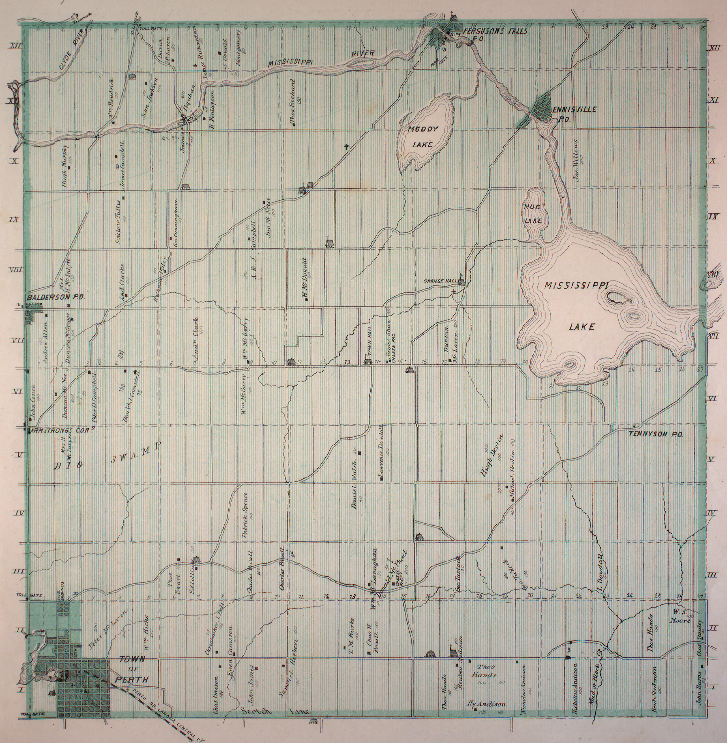
- ↑ "Township of Bathurst" (JPG). Canadian County Atlas Project. McGill University. 2001. Retrieved 2014-01-28.
Other map sources:
- Map 11 (PDF) (Map). 1 : 700,000. Official road map of Ontario. Ministry of Transportation of Ontario. 2010-01-01. Retrieved 2014-01-28.
- Restructured municipalities - Ontario map #5 (Map). Restructuring Maps of Ontario. Ontario Ministry of Municipal Affairs and Housing. 2006. Retrieved 2014-01-28.