Mount Elliot, Queensland
| Mount Elliot Queensland | |||||||||||||||
|---|---|---|---|---|---|---|---|---|---|---|---|---|---|---|---|
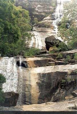 Alligator Creek Falls, 1997 | |||||||||||||||
 Mount Elliot | |||||||||||||||
| Coordinates | 19°30′25″S 146°57′32″E / 19.5069°S 146.9588°ECoordinates: 19°30′25″S 146°57′32″E / 19.5069°S 146.9588°E | ||||||||||||||
| Postcode(s) | 4816 | ||||||||||||||
| Area | 283.7 km2 (109.5 sq mi) | ||||||||||||||
| LGA(s) | City of Townsville | ||||||||||||||
| State electorate(s) | Burdekin | ||||||||||||||
| Federal Division(s) | |||||||||||||||
| |||||||||||||||
Mount Elliot is a locality in the City of Townsville, Queensland, Australia.[1] It is also a mountain also known as Mount Elliot.[2]
Geography
The locality contains the mountain which rises to a peak of 1220 metres above sea level, with the surrounding localities at 50-100 metres above seal level. The entire locality forms part of the Bowling Green Bay National Park with the Alligator Creek and its waterfall being within that Mount Elliot part of the park.[3]
The Bruce Highway and the North Coast railway line form the northern boundary of the locality.[3] The former Clevedon railway station was on the railway line in that area and the northern part of Mount Elliot is still known as Clevedon.[4]
Mount Elliot is a watershed with the northern and western parts of the mountain draining into the Ross River which enters the Coral Sea at Townsville City and the southern and eastern parts of the mountain draining into the Haughton River which enters the Coral Sea near Giru.[3]
History
The locality was named after Gilbert Eliot, the member of the Legislative Assembly of Queensland for Wide Bay in the first Queensland Parliament which was formed in 1860. He was also the first Speaker of the Queensland Legislative Assembly. The spelling was corrupted over time to Elliot.[1]
References
- 1 2 "Mount Elliot - locality in City of Townsville (entry 44609)". Queensland Place Names. Queensland Government. Retrieved 8 November 2017.
- ↑ "Mount Elliot - mountain in the City of Townsville (entry 11545)". Queensland Place Names. Queensland Government. Retrieved 11 December 2017.
- 1 2 3 "Queensland Globe". State of Queensland. Retrieved 11 December 2017.
- ↑ "Clevedon - unbounded locality in City of Townsville (entry 7409)". Queensland Place Names. Queensland Government. Retrieved 11 December 2017.
External links
![]()
| Urban |
|
|---|---|
| Rural |
|
| Northern Beaches | |
| Magnetic Island | |