Clackmannan
Clackmannan
| |
|---|---|
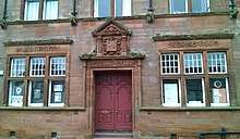
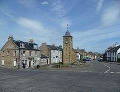 Main Street and Tolbooth, Clackmannan | |
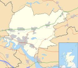 Clackmannan Clackmannan shown within Clackmannanshire | |
| Area | 0.40 sq mi (1.0 km2) |
| Population | 3,348 [2] (2008 est.) |
| • Density | 8,370/sq mi (3,230/km2) |
| OS grid reference | NS911919 |
| Council area | |
| Lieutenancy area | |
| Country | Scotland |
| Sovereign state | United Kingdom |
| Post town | CLACKMANNAN |
| Postcode district | FK10 |
| Dialling code | 01259 |
| Police | Scottish |
| Fire | Scottish |
| Ambulance | Scottish |
| EU Parliament | Scotland |
| UK Parliament | |
| Scottish Parliament | |


Clackmannan (![]()
History and toponymy

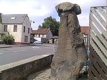
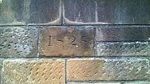
The name of the town refers to the Stone of Manau[5] or Stone of Mannan,[6] a pre-Christian monument that can be seen in the town square beside the Tolbooth or Tollbooth Tower, which dates from 1592.[7]

During the 12th century, the area formed part of the lands controlled by the abbots of Cambuskenneth. Later it became associated with the Bruce family, who, during the 14th century, built a strategic tower-house. It still stands above the town according to Historic Scotland, but entry is forbidden (because of subsidence).
A crater on asteroid 253 Mathilde is named after Clackmannan. Because Mathilde is a dark, carbonaceous body, its craters have been named after famous coalfields from across the world. The Clackmannan Group is the name given to a suite of rocks of late Dinantian and Namurian age laid down during the Carboniferous period in the Midland Valley of Scotland. The war memorial was designed by Sir Robert Lorimer in 1919.[8]
See also
- List of places in Clackmannanshire
- Clackmannan (UK Parliament constituency)
- Clackmannan F.C. Former Scottish League members
References
- ↑ Mac an Tàilleir, Iain (2003) Placenames Archived 25 December 2010 at the Wayback Machine..(pdf) Pàrlamaid na h-Alba. Retrieved 2011-05-29.
- 1 2 Population Breakdown by Settlement 2009, ClacksWeb Retrieved 2011-05-29.
- ↑ The Imperial gazetteer of Scotland. 1854. Vol.I. (AAN-GORDON) by Rev. John Marius Wilson. pp.270-271. https://archive.org/stream/imperialgazettee01wils#page/270/mode/2up
- ↑ Forsyth, Valerie (7 March 2018). "A Walk in the Past: History of the Mannan Stone". Alloa Advertiser. Retrieved 4 April 2018.
- ↑ Rhys, John, Sir (1904). Celtic Britain (3rd ed.). London: Society for Promoting Christian Knowledge. p. 155. Retrieved 3 February 2018.
- ↑ Márkus, Gilbert (2008). "Tracing Emon: Insula Sancti Columbae de Emonia". Innes Review. Edinburgh University Press. 55 (1): 3. doi:10.3366/inr.2004.55.1.1.
- ↑ "Clackmannan". Gazetteer for Scotland. Retrieved 12 July 2015.
- ↑ Dictionary of Scottish Architects: Robert Lorimer
| Wikimedia Commons has media related to Clackmannan. |
External links
- Clackmannan Library
- Clackmannan Tower: Clackmannan Towers Official Website
- ClacksNet: Clackmannanshire's Community network
- Look Aboot Ye - Clackmannanshire Community News, Information and Forums
- Clackmannan Town Hall Trust - Putting the heart back into our community
- Clackmannan Loyal - Horseshoe Bar Rangers Supporters Club