Clérette
| Clérette | |
|---|---|
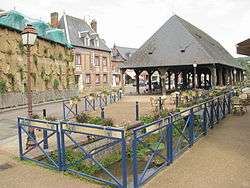 The Clérette at Clères | |
| Country | France |
| Physical characteristics | |
| Main source |
Clères 178 m (584 ft) |
| River mouth |
The Cailly River at Montville 49°54′N 1°07′E / 49.900°N 1.117°ECoordinates: 49°54′N 1°07′E / 49.900°N 1.117°E |
| Length | 10 km (6.2 mi) |
| Discharge |
|
| Basin features | |
| Basin size | 67 km2 (26 sq mi) |
The Clérette is a river of Normandy, France, 10 kilometres (6.2 mi) in length,[1] flowing through the department of Seine-Maritime.
Geography
The Clérette has its source in the northern part of the territory of the commune of Clères. Taking a southern route, it passes the hamlet of Le Tot then flows through the commune of Anceaumeville, meeting the Cailly River at Montville.
The average flow of the Clérette at Montville, where it joins the Cailly River, is 3 m³ / second. .[2]
See also
Bibliography
- Albert Hennetier, Aux sources normandes: Promenade au fil des rivières en Seine-Maritime, Ed. Bertout, Luneray, 2006 ISBN 2867436230
Notes
- ↑ Fiche de la Clérette
- ↑ Fiche de la Clérette on the SANDRE website. Consulted 11 June 2008.
External links
- The Clérette on the Sandre website (in French)
- Accès aux villes et villages de France du Quid (in French)
- French Geography website (in French)
This article is issued from
Wikipedia.
The text is licensed under Creative Commons - Attribution - Sharealike.
Additional terms may apply for the media files.