Church Crookham
| Church Crookham | |
|---|---|
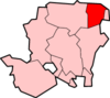
 Church Crookham Church Crookham shown within Hampshire | |
| Population | 8,479 (2011 Census)[1] |
| OS grid reference | SU810523 |
| Civil parish |
|
| District | |
| Shire county | |
| Region | |
| Country | England |
| Sovereign state | United Kingdom |
| Post town | FLEET |
| Postcode district | GU52 |
| Dialling code | 01252 |
| Police | Hampshire |
| Fire | Hampshire |
| Ambulance | South East Coast |
| EU Parliament | South East England |
| UK Parliament | |
Church Crookham is a large suburban village and civil parish contiguous with the town of Fleet, in northeast Hampshire, England, located 39 miles (63 km) southwest of London. Formerly a separate village and now generally considered as a southern suburb of Fleet, the area comprises one of the 18 wards of the Hart District, in addition to parts of two others. The southwest of the village incorporates the Zebon Copse housing development constructed in the late-1980s.
History
Crookham (formerly Crokeham) dates back at least as far as the Domesday Book, though Church Crookham and Crookham Village did not become distinct entities until the founding of the Christ Church in 1840.[2] It is this church for which Church Crookham is named.
The region had few inhabitants at this time, with the 1831 edition of Samuel Lewis's "Topographical Dictionary of England" claiming Crookham had 623 inhabitants and not even mentioning the (at the time) much smaller Fleet.[3]
The Second World War
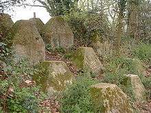
Church Crookham lies on GHQ Line – the most important of a number of fortified stop lines constructed as a part of British anti-invasion preparations of World War II – and was at one of the most heavily fortified sections of that line.[4][5]
Notes of interest
Motorists entering Fleet from the south and west are met with signs welcoming them to Church Crookham, whereas those entering the town from the north and east are welcomed to Fleet instead.
The Basingstoke Canal passes through Church Crookham.
Vertu mobile phones are made at the company headquarters, located in Church Crookham. The HSES Group headquarters are located in Church Crookham. The head office of Ferranti Thomson Sonar Systems was on the Redfields Industrial Estate, to the south of the town.
John Keble was a regular visitor to Church Crookham's Christ Church.[6]
Queen Elizabeth Barracks was military installation in the village used by the British Army from 1938 to 2000.[7][8]
Tweseldown race course
Tweseldown race course was a point-to-point horse racing track. This race track was used for the eventing steeplechase in the 1948 London Olympics.[9]
Filming location
Church Crookham has been used as a filming location for several films. These include the 2002 James Bond movie Die Another Day, which used woodland and flat ground in between Church Crookham and Aldershot to represent the demilitarised zone between North and South Korea.[10] Church Crookham was also one of several English towns and villages (others including nearby Aldershot, Farnham, and Chobham) that served as filming locations for the 2006 movie Children of Men.
Tobacco
Church Crookham was the location for the only commercially successful tobacco plantation in Britain, which produced among other brands "Blue Pryor" cigarettes and pipe tobacco. Production finished in 1938 and the plantation site is now occupied by Redfields Garden Centre, but Redfields House is part of the buildings that now encompass St Nicholas' School.[11]
Redfields was also the centre for the British Pioneer Tobacco Growers Association (BPTGA) after the Second World War. Tobacco was grown there, cured and a commercial brand 'Trowards Rayon D'or' was produced alongside the main purpose of supplying plants to members, curing and shredding their final product before returning to the appropriate members. Among members of the staff were Charles Baggs, general manager throughout their existence, and Admiral Sir Clement Moody. A BBC film was made during the 1950s entitled Tobacco Road which featured the Redfields site and their site in nearby Crondall. The Association closed after the death of Mr Troward, although Charles Baggs did continue to supply plants and cure the members' product for a further period after his death. The works at Redfields employed some twenty to thirty local staff, which demonstrated its importance at that time in history.
Education
For a list of local schools see the list of Hampshire schools.
References
Notes
- ↑ "Civil Parish population 2011". Neighbourhood Statistics. Office for National Statistics. Retrieved 12 December 2016.
- ↑ Church Crookham.co.uk. "Church Crookham: A pleasant village in Hampshire, England". Retrieved 28 November 2006.
- ↑ Hantsweb. "A Little Local History". Retrieved 28 November 2006.
- ↑ Foot, 2006, p335-341
- ↑ "Defending Chequers Bridge". Pillbox study group. Archived from the original on 15 May 2007. Retrieved 2 February 2007.
- ↑ Guildford Diocese. "Aldershot Deanery > Crookham". Archived from the original on 29 September 2006. Retrieved 28 November 2006.
- ↑ Quent, Karl. "What's under the earth we dig" (PDF). Church Crookham Allotments Association. Retrieved 3 June 2018.
- ↑ "ASU Building, QE Barracks, Church Crookham" (PDF). Oxford Archaeology. p. 3. Retrieved 3 June 2018.
- ↑ House and Hound (2006). "BEF says Greenwich will work in 2012". Retrieved 28 November 2006.
- ↑ News.com.au (7 October 2006). "Licence to thrill". The Courier-Mail. Retrieved 28 November 2006.
- ↑ Roe, Ted (1975). Mainly about Old Fleet and Crookham.
General references
- Foot, William (2006). Beaches, fields, streets, and hills ... the anti-invasion landscapes of England, 1940. Council for British Archaeology. ISBN 1-902771-53-2.
External links
| Wikimedia Commons has media related to Church Crookham. |
- http://www.church-crookham.co.uk
- Fleet & Crookham Local History Group – Group Books and Historical Papers – includes reference to paper "Mr Brandon's Tobacco Farm" by Phyllis Ralton (2007)