Chrysi (island)
| Native name: Χρυσή | |
|---|---|
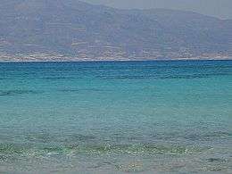 A view of Crete from the island of Chrissi. | |
 Chrissi | |
| Geography | |
| Coordinates | 34°52′N 25°43′E / 34.87°N 25.71°ECoordinates: 34°52′N 25°43′E / 34.87°N 25.71°E |
| Archipelago | Cretan Islands |
| Highest point | 31 |
| Administration | |
|
Greece | |
| Region | Crete |
| Regional unit | Lasithi |
| Demographics | |
| Population | 3 (2017) |
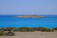
Chrissi (Greek: Χρυσή or Chrisi, "golden", also Γαϊδουρονήσι - Gaidouronisi "donkey island") is an uninhabited Greek island approximately 15 kilometres (9 miles) south of Crete close to Ierapetra in the South Cretan Sea.[1][1] Approximately 700 metres (2,300 feet) east of the island is the island of Mikronisi. Administratively these islands fall within the Ierapetra municipality in Lasithi.
It contains a small church and harbour on its northwestern coast, Ekklisia Agios Nikolaos.
Tourism
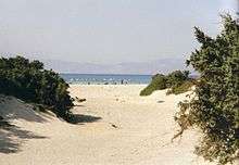
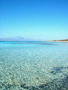
It is possible to visit Chrissi by sea from Ierapetra and from Myrtos. There is a nudist beach on the north coast of the island. The highest point on the island is called Kefala ("head") and it is 31 metres (102 feet) above sea level. On the western part of the island is the chapel of Saint Nicholas (estimated to date to the 13th century). There are also a salt pan, an old port, some Minoan ruins, a lighthouse and a Roman cemetery. Due to the shallow waters around Chrissi, snorkelling and diving is a popular pastime. The Belegrina, Hatzivolakas, and Kataprosopo bays have a wide diversity of shells.
It is possible to reach the island from Ierapetra between middle of May and late October. During the summer months, excursion boats from Ierapetra leave the quay every morning and return in the afternoon.[2][3]
Environmental protection
Chrissi is protected as an "area of intense natural beauty". The island has the largest naturally formed Juniperus macrocarpa forest in Europe. There is no fresh drinking water on the island. The majority of trees have an average age of 200 years and average height of up to 7 metres (23 feet), some of the trees are up to 300 years old and 10 metres (33 feet) tall. The density is approximately 28 trees per hectare.[4]
See also
References
- 1 2 Isaakidou, Valasia; Tomkins, Peter (2008). Escaping the labyrinth: the Cretan neolithic in context. Oxbow Books. p. 218. ISBN 978-1-84217-291-9. Retrieved 5 June 2013.
- ↑ Pungetti, Gloria; Mannion, Antoinette M. (2008). Mediterranean Island Landscapes: Natural and Cultural Approaches. Springer. p. 65. ISBN 978-1-4020-5064-0. Retrieved 5 June 2013.
- ↑ Alexis Averbuck; Michael S Clark (1 May 2012). Lonely Planet Greek Islands. Lonely Planet. p. 356. ISBN 978-1-74321-078-9. Retrieved 5 June 2013.
- ↑ Natura 2000 site GR 4320003 Archived 2011-09-27 at the Wayback Machine. (Greek)
External links
- Chrissi Island (English, Italian, Greek and auto translation options)
- Ierapetra Community, Island Chrysi (Greek)
- Chrissi Island (English)