Choestoe, Georgia
| Choestoe, Georgia | |
|---|---|
| Unincorporated community | |
 Choestoe, Georgia Location within the state of Georgia  Choestoe, Georgia Choestoe, Georgia (the US) | |
| Coordinates: 34°47′43″N 83°53′14″W / 34.79528°N 83.88722°WCoordinates: 34°47′43″N 83°53′14″W / 34.79528°N 83.88722°W | |
| Country | United States |
| State | Georgia |
| County | Union |
| Elevation | 1,939 ft (591 m) |
| Time zone | UTC-5 (Eastern (EST)) |
| • Summer (DST) | UTC-4 (EDT) |
| Area code(s) | 706 & 762 |
| GNIS ID | 331396[1] |
Choestoe is an unincorporated community in Union County, Georgia, United States.[1][2]
Choestoe is a name most likely derived from the Cherokee language meaning "rabbit place".[3]
Notes
- 1 2 "Choestoe, Georgia". Geographic Names Information System. United States Geological Survey.
- ↑ Georgia Department of Transportation-Union County
- ↑ Krakow, Kenneth K. (1975). Georgia Place-Names: Their History and Origins (PDF). Macon, GA: Winship Press. p. 42. ISBN 0-915430-00-2.
Municipalities and communities of Union County, Georgia, United States | ||
|---|---|---|
| City | 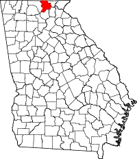 | |
| Unincorporated communities | ||
This article is issued from
Wikipedia.
The text is licensed under Creative Commons - Attribution - Sharealike.
Additional terms may apply for the media files.