Chiquitos Province
| Chiquitos | ||
|---|---|---|
| Province | ||
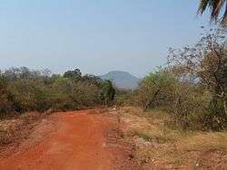 Road in Santa Cruz la Vieja historical park with the mountain Turubó in the background, San José Municipality, Chiquitos Province | ||
| ||
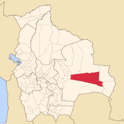 Location of Chiquitos Province within Bolivia | ||
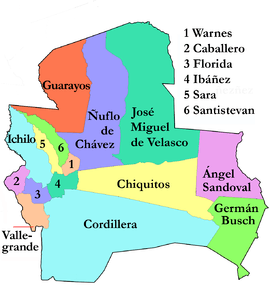 Provinces of Santa Cruz Department | ||
| Coordinates: 18°0′S 60°0′W / 18.000°S 60.000°W | ||
| Country |
| |
| Department | Santa Cruz Department | |
| Cantons | 9 | |
| Foundation | January 23, 1826 | |
| Capital | San José de Chiquitos | |
| Area | ||
| • Total | 12,135 sq mi (31,429 km2) | |
| Elevation | 971 ft (296 m) | |
| Population (2001) | ||
| • Total | 59,754 | |
| • Density | 5/sq mi (1.9/km2) | |
| Area code(s) | BO.SC.CQ | |
| Website | www.santacruz.gob.bo | |

Chiquitos Province is one of the fifteen provinces of the Bolivian Santa Cruz Department, situated in the center of the department. Its capital is San José de Chiquitos.
The province was created on January 23, 1826, during the presidency of marshal Antonio José de Sucre.
It forms the so-called "Gran Chiquitania" together with José Miguel de Velasco Province, Ñuflo de Chávez Province, Ángel Sandoval Province, and Germán Busch Province.
Location
Chiquitos Province is located between 17° 00' and 18° 37' South and between 58° 54' and 62° 45' West. It extends over 500 km from West to East, and up to 220 km from North to South.
The province is situated in the Bolivian lowlands and borders Ñuflo de Chávez Province in the northwest, Andrés Ibáñez Province in the west, Cordillera Province in the south, Germán Busch Province in the southeast, Ángel Sandoval Province in the east, and José Miguel de Velasco Province in the north.
Division
Chiquitos Province comprises three municipalities which are further subdivided into cantons.
| Section | Municipality | Seat |
|---|---|---|
| 1st | San José de Chiquitos Municipality | San José de Chiquitos |
| 2nd | Pailón Municipality | Pailón |
| 3rd | Roboré Municipality | Roboré |
Population
The population of Chiquitos Province has increased by circa 15% over the recent five years, from 59,754 inhabitants (2001 census) to 68,445 inhabitants (2005 est.).[1] A substantial part of the population consists of German speaking Mennonites from Russia.
Environment
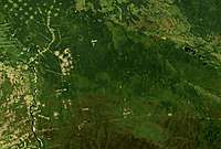
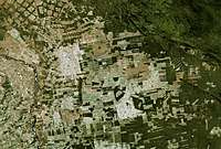
Increased agricultural use of the land has led to deforestation in the area.
Places of interest
References
- ↑ Instituto Nacional de Estadística Archived August 25, 2007, at the Wayback Machine.