Chicken Strip
| Chicken Strip | |||||||||||
|---|---|---|---|---|---|---|---|---|---|---|---|
 | |||||||||||
| Summary | |||||||||||
| Airport type | Public (uncharted) | ||||||||||
| Owner/Operator | National Park Service | ||||||||||
| Location | Death Valley National Park | ||||||||||
| Elevation AMSL | 1,360 ft / 415 m | ||||||||||
| Coordinates | 36°48′24″N 117°46′54″W / 36.80667°N 117.78167°W | ||||||||||
| Map | |||||||||||
 Chicken Strip Location of airport in California  Chicken Strip Chicken Strip (the US) | |||||||||||
| Runways | |||||||||||
| |||||||||||
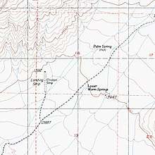
Chicken Strip is a non-towered dirt airstrip not depicted on an FAA Sectional chart. The airstrip provides general aviation fly-in access to the Saline Valley hot springs in Death Valley National Park. The closest airport to the airstrip is Lone Pine Airport at 20 miles (17 nmi; 32 km) to the southwest and the closest airport with regular airline service is Fresno Yosemite International Airport at 107 miles (93 nmi; 172 km) to the west.[1] Chicken Strip was built in the 1960s to provide quicker access to the nearby hot springs, sometimes called the warm springs, that are a short walking distance away. Without the airport the only other access to the Saline Valley hot springs is an arduous, 40 miles (64 km) dirt road that can take 3 to 4 hours to complete.[2]
History
- On August 7, 2011 the National Park Service (NPS) closed Chicken Strip due to safety concerns.[3] The Recreational Aviation Foundation (RAF) worked with the NPS to repair the strip. Volunteers from the RAF and BackcountryPilot.org worked to restore Chicken Strip to the satisfaction of the NPS. Chicken Strip reopened to the public on October 15, 2011. [4]
- In July 2016 Chicken Strip closed because the airstrip had become too rough from storm damage to safely land on but with quick action from RAF volunteers the airstrip reopened in September 2016.[5]
.jpg)
Facilities
Chicken Strip is at an elevation of 1,360 ft (410 m) above mean sea level. It has one, sightly up-sloping, dirt runway:[6]
- Runway headings are approximately 18/36 measuring 1,350 x ~30 ft (411 x ~9 m)[7]
References
- ↑ "SkyVector: Flight Planning / Aeronautical Charts". skyvector.com. Retrieved 2018-06-08.
- ↑ "CHICKEN STRIP REOPENS". Recreational Aviation Foundation. Retrieved January 27, 2016.
- ↑ "Fate of California's Chicken Strip airstrip open for input". www.aopa.org. 2014-01-29. Retrieved 2018-04-18.
- ↑ "Featured Airstrip | Recreational Aviation Foundation". theraf.org. Retrieved 2018-04-18.
- ↑ "Saline Valley's Backcountry Airstrip Temporarily Closed for Safety - Death Valley National Park (U.S. National Park Service)". www.nps.gov. Retrieved 2018-04-18.
- ↑ "Death Valley and Saline Valley Hot Springs: The Chicken Strip". West Coast Flying Adventures. 2010-05-12. Retrieved 2018-04-18.
- ↑ SHORTFIELD. "No ID 067 - Chicken Strip, CA". ShortField.com. Retrieved 2018-04-18.