Cher (river)
| Cher | |
|---|---|
 The Cher | |
| Native name | Le Cher |
| Country | France |
| Physical characteristics | |
| Main source |
Massif Central 762 m (2,500 ft) |
| River mouth |
Loire 47°20′33″N 0°28′49″E / 47.34250°N 0.48028°ECoordinates: 47°20′33″N 0°28′49″E / 47.34250°N 0.48028°E |
| Length | 367.8 km (228.5 mi) |
| Discharge |
|
| Basin features | |
| Progression | Loire→ Atlantic Ocean |
| Basin size | 13,718 km2 (5,297 sq mi) |
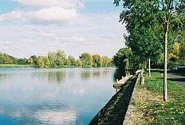
The Cher (Occitan: Char) is a river in central France, a left tributary of the Loire. It is 367.8 km (228.5 mi) long and its basin area is 13,718 km2 (5,297 sq mi).[1] Its source is in the Creuse department, north-east of Crocq. It joins the river Loire at Villandry, west of Tours.
The river suffered a devastating flood in 1940, which damaged the Château de Chenonceau, which spans the river, and other structures along the banks. It owes its name to the pre-Indo-European root kʰar 'stone'.
Departments and towns
The Cher flows through the following departments, and along the following towns:[2]
Tributaries
The main tributaries of the Cher are, from spring to mouth (L: left / R: right):
Navigation
The Cher was part of a network of waterways that linked the city of Tours to Nevers, where connections to other regions of France existed. As of 2018, only the 54 kilometres (34 mi) section between Larçay (southeast of Tours) and Noyers-sur-Cher is navigable for small boats (maximum draft 80 cm). It has 14 locks.[3] At Noyers-sur-Cher, it is connected with the Canal de Berry, of which only the westernmost 15 kilometres (9.3 mi) section until Selles-sur-Cher is navigable.[4]
References
- ↑ Sandre. "Fiche cours d'eau - Cher (K---0090)".
- ↑ "Geoportail Homepage". Geoportail.fr (in French). Retrieved 2017-06-17.
- ↑ Fluviacarte, Cher
- ↑ Fluviacarte, Canal de Berry