Cheboygan River
| Cheboygan River | |
|---|---|
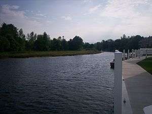 Cheboygan River flowing through Cheboygan | |
| Country | United States |
| Physical characteristics | |
| Main source |
Mullett Lake 594 ft (181 m)[1] |
| River mouth |
Lake Huron at Cheboygan 581 ft (177 m)[2] |
| Length | 7.0 mi (11.3 km) |
The Cheboygan River (/ʃɛˈbɔɪɡən/ shi-BOY-gən)[3] is a short but significant river in the Lake Huron drainage basin of the U.S. state of Michigan.
Seven miles (11.3 km) in length,[4] the Cheboygan River flows from the north end of Mullett Lake at 45°34′37″N 84°29′16″W / 45.57694°N 84.48778°W to the Straits of Mackinac at 45°39′22″N 84°27′55″W / 45.65611°N 84.46528°W.[2] The river forms the boundary between Benton Township and Inverness Township before flowing into the city of Cheboygan. The largest tributary is the Black River. The Cheboygan River is entirely contained within Michigan's Cheboygan County, and the county seat of Cheboygan is located at the river's mouth. The river forms the port of Cheboygan and serves as a dock for the ferry boat to Bois Blanc Island and the Coast Guard cutter Mackinaw.[5]
Cheboygan was founded as a lumbering town to cut timbers harvested from the Cheboygan River's drainage and floated down to mills (now mostly vanished) at the mouth of the river. Today, one of the biggest industries of the town and river of Cheboygan is pleasure boating up and down the river. The river is a key artery of the Inland Waterway, a pleasure-boat necklace of waterways in the northern section of Michigan's Lower Peninsula.
The river is the namesake for the city and county.[6] "Cheboygan" is pronounced the same as "Sheboygan" (a city in Wisconsin).[3]
Description
The Cheboygan River descends 13 feet (4.0 m) in its 6-mile (9.7 km) length, from 594 feet (181 m) above sea level, the level of Mullett Lake, to Lake Huron at 581 feet (177 m) above sea level. The river and other sections of the Inland Waterway are made accessible by locks maintained by the United States Army Corps of Engineers.
The mouth of the Black River, 3.5 miles (5.6 km) south of Cheboygan, is a noted spot to look for bald eagles and other fish-eating raptors.
In Cheboygan itself, U.S. Highway 23 is carried across the Cheboygan River by the Cheboygan Bascule Bridge, a Scherzer rolling lift bridge built in 1940 and added to the National Register of Historic Places in December 1999. In 2009, Cheboygan city authorities built an elevated pedestrian bridge across the Cheboygan near its mouth.[7]
The mouth of the Cheboygan River into Lake Huron is marked by the Cheboygan Crib Light.
See also
References
- ↑ U.S. Geological Survey Geographic Names Information System: Mullett Lake
- 1 2 U.S. Geological Survey Geographic Names Information System: Cheboygan River
- 1 2 Merriam-Webster's Geographical Dictionary (3rd ed.). Merriam-Webster. 1997. p. 237. ISBN 9780877795469.
Che•boy•gan \shi-'bȯi-gən\.
- ↑ U.S. Geological Survey. National Hydrography Dataset high-resolution flowline data. The National Map Archived 2012-04-05 at WebCite, accessed November 21, 2011
- ↑ Michigan Atlas and Gazetteer (Map) (10th ed.). DeLorme. 2002.
- ↑ "Bibliography on Cheboygan County". Clarke Historical Library, Central Michigan University. Retrieved January 19, 2013.
- ↑ "Cheboygan authority approves river bridge design". Cheboygan Daily Tribune. 2008-11-20. Archived from the original on 2011-07-08.
External links
| Wikimedia Commons has media related to Cheboygan River. |