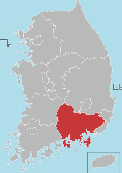
Changnyeong County
| Changnyeong 창녕군 | ||
|---|---|---|
| County | ||
| Korean transcription(s) | ||
| • Hangul | 창녕군 | |
| • Hanja | 昌寧郡 | |
| • Revised Romanization | Changnyeong-gun | |
| • McCune-Reischauer | Ch'angnyeong-gun | |
| ||
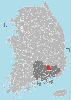 Location in South Korea | ||
| Country |
| |
| Region | Yeongnam | |
| Administrative divisions | 2 Towns (읍 eup), 12 Townships (면 myeon) | |
| Area | ||
| • Total | 533.09 km2 (205.83 sq mi) | |
| Population (2008) | ||
| • Total | 61,752 | |
| • Density | 140.1/km2 (363/sq mi) | |
| • Dialect | Gyeongsang | |
Changnyeong County (Changnyeong-gun 창녕군) is a county in South Gyeongsang Province, South Korea.
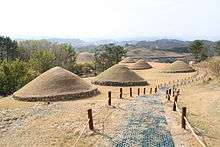
In the early Three Kingdoms period, Changnyeong was the seat of Bihwa Gaya, a member of the Gaya confederacy which was later conquered by Silla.
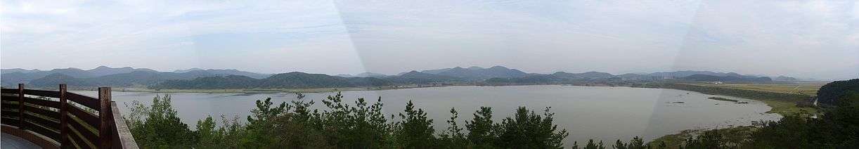
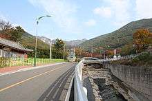
The Nakdong River flows through the county. The Upo wetland, an important ecological resource and tourist attraction, occupies a portion of the river basin.
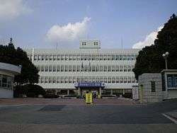
The county government is located in Changnyeong Town (창녕읍), the largest town and center of the county.
Famous people from Changnyeong include North Korean actress Song Hye-rim.
Etymology
Changnyeong means "prosperous peace", from the Sino-Korean roots chang (창; 昌; lit. "prosperity") and nyeong (녕; 寧; lit. "peace").
History
- 1631 Established as Yeongsan territory 영산 현
- 1637 Changnyeong territory was added 창녕 현·영산현
- 1895 On the first of May (lunar calendar 음력) Changnyeong and Yeongsan were incorporated under Daegu as separate counties 대구부 창녕군·영산군 [1]
- 1896 8월 4일 Changnyeong and Yeongsan county are incorporated into South Gyeongsang province 경상남도 창녕군·영산군 [2]
- 1914 4월 1일 Yeongsan County (영산군, 靈山郡) and Changnyeong county 창녕군 are merged into [3]
- 15 townships (면) - Eubnae 읍내면, Goam 고암면, Seonsan 성산면, Daehap 대합면, Ibang 이방면, Yueo유어면, Daeji 대지면, Changnak 창락면, Namgok 남곡면, Jangma 장마면, Bugok 부곡면, Yeongsan 영산면, Gilgok 길곡면, Docheon 도천면, Gyeseong 계성면
- 1918 Eupnae township's name 읍내면 is changed to Changnyeong 창녕면.
- 1936 4월 1일 Namgok township's name 남곡면 is changed to Namji 남지면.[4]
- 1955 7월 1일 Changnak township 창락면 is merged with Changnyeong township창녕면.[5] (14면)
- 1960 On the first of January, Changnyeong township becomes Changnyeong town [6]
- 1963 On the first of January, Namji township becomes Namji town[7]
- 1971 Namji local town hall established.
Administrative divisions
Changnyeong is made up of two towns (읍), 12 townships (면) 139 villages (리) over an area of 532.72㎢.[8] Of the 28,466 households and 61,789 people living in Changnyeong county in 2011 27.1% were living in Changnyeong town (창녕읍), 18.4% living in Namji town (남지읍).[9]
| Towns·Townships | Korean | Hanja | Households | Population | Area | |
|---|---|---|---|---|---|---|
| Changnyeong | 창녕읍 | 昌寧邑 | 6,923 | 16,723 | 61.42 | 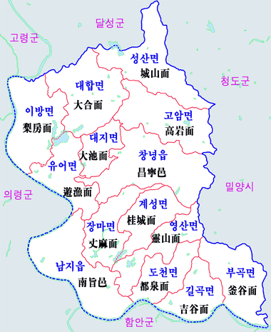 Changnyeong Township map |
| Namji | 남지읍 | 南旨邑 | 5,052 | 11,343 | 55.23 | |
| Goam | 고암면 | 高岩面 | 1,116 | 2,001 | 44.48 | |
| Seongsan | 성산면 | 城山面 | 871 | 1,598 | 47.03 | |
| Daehab | 대합면 | 大合面 | 2,002 | 4,016 | 46.56 | |
| Ibang | 이방면 | 梨房面 | 1,375 | 2,794 | 46.60 | |
| Yueo | 유어면 | 遊漁面 | 1,029 | 1,980 | 33.29 | |
| Daeji | 대지면 | 大池面 | 1,129 | 2,450 | 17.87 | |
| Kyeseong | 계성면 | 桂城面 | 1,293 | 2,618 | 27.86 | |
| Yeongsan | 영산면 | 靈山面 | 2,689 | 6,047 | 29.36 | |
| Jangma | 장마면 | 丈麻面 | 1,010 | 1,925 | 29.99 | |
| Docheon | 도천면 | 都泉面 | 1,357 | 2,848 | 25.45 | |
| Kilgok | 길곡면 | 吉谷面 | 738 | 1,486 | 27.57 | |
| Bugok | 부곡면 | 釜谷面 | 1,882 | 3,960 | 27.57 |
Tourism
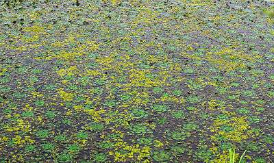
- Upo wetland (우포 늪)[10]
Upo wetland in Changnyeong county is the largest wetlands in all of Korea. These wetlands are estimated to be created about 140 million years ago. It spreads out over Changnyeong county's Yueo, Ibang, Daehap, Daeji and other townships, covering over 2,310,000㎡, with a circumference area of 7.5 km. There are over 340 species of endangered plants such as the Euryale ferox, as well as 62 wild birds, and 28 fish located within the swamp.
Upo wetland was designated as a natural monument during the time of Japanese occupation in 1933. As soon as the Cultural Properties Protection Law was enacted in December 3, 1962, the wetland was designated as Cultural property 15 under the name of Changnyeong Swan habitat. However, on July 19 of 1973 it was found that migratory bird numbers had decreased and therefore its status as a natural monument was cancelled. After another evaluation done in January 13, 2001 in order to determine the geographical scenic value of the biology living there, it was determined that the wetlands be considered natural preserve area number 524.[11]
- Bugok Hot Springs (부곡온천)
In 1973 a hot springs resort was developed in Keomun village in the Bugok township (부곡면 거문리). Bugok In that year, after the natural hot springs was discovered under scenic Deokam Mountain (덕암산). The 48 geothermal wells that were discovered produce in one day an abundance of over 3,000 tons of hot springs well water. In 1977년 Bugok was determined to be a national tourist attraction with high quality hotels, recreational facilities, parks and forestation. One of the most famous hotel and spa is Bugok Hawaii, a resort style facility with a water and amusement park as well as a large hotel.
- Bugok Hawaii (부곡하와이)
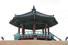
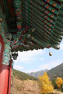
- Mount Hwawang (화왕산)[12]
Educational Institutions
High Schools (고등학교)
- Namji High and Middle School 남지고등학교
- Yeongsan High and Middle School 영산고등학교
- Changnyeong High School 창녕고등학교
- Changnyeong Technical High School 창녕공업고등학교
- Changnyeong Daeseong High School 창녕대성고등학교
- Changnyeong Girl's High School 창녕여자고등학교
- Changnyeong Ogya High and Middle School 창녕옥야고등학교
- Changnyeong First High and Middle School 창녕제일고등학교
Middle Schools (중학교)
- Namji Girl's Middle School 남지여자중학교
- Namji Middle School 남지중학교
- Daeseong Middle School 대성중학교
- Bugok Middle School 부곡중학교
- Seongsan Middle School 성산중학교
- Shinchang Girl's Middle School 신창여자중학교
- Yeongsan Middle School 영산중학교
- Changnyeong Girl's Middle School 창녕여자중학교
- Changnyeong Ogya Middle School 창녕옥야중학교
- Changnyeopng Middle School 창녕중학교
Twin towns – sister cities
Changnyeong is twinned with:
See also
References
- ↑ 칙령 제98호 地方制度改正件 (1895년 음력 5월 26일)
- ↑ 칙령 제36호 地方制度官制改正件 (1896년 8월 4일)
- ↑ 조선총독부령 제111호 (1913년 12월 29일)
- ↑ 도령 제2호 (1936년 3월 3일)
- ↑ 법률 제360호 지방자치단체의폐치분합및구역변경에관한법률 (1955년 6월 29일)
- ↑ 법률 제538호 읍설치에관한법률 (1960년 1월 1일)
- ↑ 법률 제1177호 읍설치에관한법률 (1962년 11월 21일)
- ↑ 2009 Archived October 2, 2013, at the Wayback Machine., 7/21/2011 accessed
- ↑ Changnyeong population, 7/12/2011 accessed
- ↑ (경남) 혼자서 조용히 사색하며 쉴 수 있는 곳은? 《Friday》(2006.11.27.)
- ↑ 김태식 기자 (2011-01-13). "창녕 우포늪 천연기념물 재지정". 연합신문. Retrieved 2011-01-23.
- ↑ Hwawang Mountain Archived 2016-03-04 at the Wayback Machine.
External links
| Wikimedia Commons has media related to Changnyeong. |
- County government website
- Changnyeong County at Curlie (based on DMOZ)
Coordinates: 35°32′40″N 128°29′32″E / 35.544414°N 128.492181°E