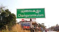
Changaramkulam
| Changaramkulam | |
|---|---|
| Village | |
 | |
 Changaramkulam Location in Kerala, India  Changaramkulam Changaramkulam (India) | |
| Coordinates: 10°44′0″N 76°1′0″E / 10.73333°N 76.01667°ECoordinates: 10°44′0″N 76°1′0″E / 10.73333°N 76.01667°E | |
| Country |
|
| State | Kerala |
| District | Malappuram |
| Languages | |
| • Official | Malayalam, English |
| Time zone | UTC+5:30 (IST) |
| PIN | 679575 |
| Telephone code | 0494 |
| Vehicle registration | KL10 and KL54 |
| Nearest city | Kunnamkulam |
| Lok Sabha constituency | Ponnani |
| Climate | normal (Köppen) |
Changaramkulam is a small town in Ponnani taluk of Malappuram district in the Indian state of Kerala. It falls on, and is shared across two panchayats—Nannammukku and Alamcode. Changaramkulam is under Ponnani Lokhsabha Constituency.
Economy
Changaramkulam is one of the prominent public markets. It was known for its weekly cattle, areca nut and food markets. Changaramkulam is situated in south side of Malappuram District, and just 5 km Distance to both Thrissur and Palakkad districts. The Kerala State Highway 69 (Thrissur Calicut Road) is passing through Changaramkulam Town.
Major roads from Changaramkulam Town are:
- Thrissur–Calicut Highway
- Changaramkulam–Naranippuzha Road (from Changaramkulam to Eramangalam: ends at Guruvayoor–Ponnani Road. Easy to access Mookkuthala, Eramangalam, Maranchery, Puthanpally, Guruvayoor & Ponnani)
- Changaramkulam–Cheruvalloor Road (from Changaramkulam To Cheruvalloor: ends at Guruvayoor–Ponnani Road. Easy To Access Nannammukku, Uppungal kadavu, Punnayoorkkulam, Althara, Vadakkekad, Guruvayoor)
- Changaramkulam-Nannammukku Road (from Changaramkulam To Nannammukku: ends at Srayikkadav-Chirakkal Road. Easy To Access Nannammukku, Srayikkadavu, Kattakampal, Chirakkal, Pazhanji, Porkulam, Kunnamkulam)
Recent developments
Nowadays Changaramkulam has gained a lot of developments. The town has almost all major banks, hospital, schools, colleges, etc. The town comes under Changaramkulam Police Station ( Ponnani Circle – Tirur Dysp Office ).
- Police Station: Changaramkulam Police Station
- Hospitals: Sunrise Hospital(old Arafa Hospital), Mother & Child Hospital.
- KSEB office changaramkulam.
- Grid Tie Solar Changramkulam.
Schools: PCNGHSS Mookkuthala, MVM RHSS Valayamkulam, Darussalam, SM College, Asaabah College.
Education
- College: Assabah Arts & Science College Valayamkulam
- College: Darul Ihsan Islamic & Arts College Punnakkal Changaramkulam
Culture
Changaramkulam village is a predominantly Muslim populated area. Hindus exist in comparatively smaller numbers. So the culture of the locality is based upon Muslim traditions. Duff Muttu, Kolkali and Aravanamuttu are common folk arts of this locality. There are many libraries attached to mosques giving a rich source of Islamic studies. Most of the books are written in Arabi-Malayalam which is a version of the Malayalam language written in Arabic script. People gather in mosques for the evening prayer and continue to sit there after the prayers discussing social and cultural issues. Business and family issues are also sorted out during these evening meetings. The Hindu minority of this area keeps their rich traditions by celebrating various festivals in their temples. Hindu rituals are done here with a regular devotion like other parts of Kerala. Mookuthala bagavathi temple believed as Adhi Shakaracharya installed, were parashakthi is the pradhishta. Kanneyankavu bagavathy temple were kannayankavu pooram celebrated regardless of any religion.Here Badra Kali is the deity.karinkali is the main attraction of this temple. Keezhekavu were deity is durga. Here Vidya pooja during mahanavami is important. These 3 temple have very importance in Navarathri days. Three bhavas of goddess is here. It will be really a good feeling.
Transportation
Changaramkulam village connects to other parts of India through Kuttippuram town. National highway No.66 passes through Edappal and the northern stretch connects to Goa and Mumbai. The southern stretch connects to Cochin and Trivandrum. National Highway No.966 connects to Palakkad and Coimbatore. The nearest airports are at Kozhikode Airport|Kozhikode & Kochin International Airport. The nearest major railway stations are at Kuttippuram and Guruvayoor.
References
- ↑ "Archived copy". Archived from the original on 2016-04-01. Retrieved 2016-07-14.