Červený Kostelec
| Červený Kostelec | |||
| Town | |||
_-_church_of_Saint_James.JPG) Church of Saint James | |||
|
|||
| Country | Czech Republic | ||
|---|---|---|---|
| Region | Hradec Králové | ||
| District | Náchod | ||
| Commune | Náchod | ||
| Municipality | Červený Kostelec | ||
| Elevation | 414 m (1,358 ft) | ||
| Coordinates | 50°28′36″N 16°05′34″E / 50.47667°N 16.09278°ECoordinates: 50°28′36″N 16°05′34″E / 50.47667°N 16.09278°E | ||
| Area | 24.06 km2 (9.29 sq mi) | ||
| Population | 8,355 (1.1.2017) | ||
| Density | 347/km2 (899/sq mi) | ||
| First mentioned | 1362 | ||
| Mayor | Rostislav Petrák | ||
| Timezone | CET (UTC+1) | ||
| - summer (DST) | CEST (UTC+2) | ||
| Postal code | 549 41 | ||
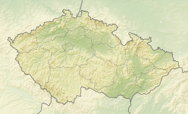 Location in the Czech Republic | |||
| Wikimedia Commons: Červený Kostelec | |||
| Statistics: statnisprava.cz | |||
| Website: www | |||

Červený Kostelec (Czech pronunciation: [ˈtʃɛrvɛniː ˈkostɛlɛts]; German: Rothkosteletz) is a town in the Náchod District, Hradec Králové Region of the Czech Republic. It has around 8,350 inhabitants.[1]
The villages of Bohdašín, Horní Kostelec, Lhota za Červeným Kostelcem, Mstětín, Olešnice and Stolín are administrative parts of Červený Kostelec.
The town's church is now painted red, representing the fire, which engulfed it in the 17th century, and gave the town its name, červený meaning red. On the south is an old quarry that had been turned into an army shooting range. The large forest of Žďár envelops the southern part of the town.
See also
References
- ↑ "Czech Statistical office - Population of Municipalities - 1 January 2017". www.czso.cz. Retrieved 2017-10-17.
External links

- Municipal website (in Czech)
- virtual show
This article is issued from
Wikipedia.
The text is licensed under Creative Commons - Attribution - Sharealike.
Additional terms may apply for the media files.