Šestajovice (Náchod District)
| Šestajovice | |||
|---|---|---|---|
| Municipality and village | |||
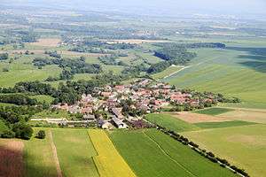 Air view | |||
| |||
| Coordinates: 50°20′13″N 16°0′16″E / 50.33694°N 16.00444°ECoordinates: 50°20′13″N 16°0′16″E / 50.33694°N 16.00444°E | |||
| Country |
| ||
| Region | Hradec Králové Region | ||
| District | Náchod District | ||
| Area | |||
| • Total | 2.90 sq mi (7.51 km2) | ||
| Elevation | 899 ft (274 m) | ||
| Population (1.1.2012) | |||
| • Total | 190 | ||
| • Density | 66/sq mi (25/km2) | ||
| Time zone | UTC+1 (CET) | ||
| • Summer (DST) | UTC+2 (CEST) | ||
_vlajka.jpg)
_znak.jpg)
Šestajovice is a village and municipality in Náchod District in the Hradec Králové Region of the Czech Republic.
| Wikimedia Commons has media related to Šestajovice (Náchod District). |
This article is issued from
Wikipedia.
The text is licensed under Creative Commons - Attribution - Sharealike.
Additional terms may apply for the media files.