Centreville, Michigan
| Centreville, Michigan | |
|---|---|
| Village | |
 Streets of Centreville | |
 Location of Centreville, Michigan | |
| Coordinates: 41°55′23″N 85°31′39″W / 41.92306°N 85.52750°W | |
| Country | United States |
| State | Michigan |
| County | St. Joseph |
| Area[1] | |
| • Total | 1.50 sq mi (3.88 km2) |
| • Land | 1.49 sq mi (3.86 km2) |
| • Water | 0.01 sq mi (0.03 km2) |
| Elevation | 820 ft (250 m) |
| Population (2010)[2] | |
| • Total | 1,425 |
| • Estimate (2016)[3] | 1,409 |
| • Density | 950/sq mi (370/km2) |
| Time zone | UTC-5 (Eastern (EST)) |
| • Summer (DST) | UTC-4 (EDT) |
| Zip Code | 49032[4] |
| Area code(s) | 269 |
| FIPS code | 26-14460[5] |
| GNIS feature ID | 1624448[6] |
Centreville is a village in the U.S. state of Michigan and the county seat of St. Joseph County.[7] The population was 1,425 at the 2010 census.
History
Centreville developed around a tavern founded here in 1831 by European-American settler, Thomas W. Langley. It was incorporated as a village in 1837.[8]
Centreville is the location of the Langley Covered Bridge, a historic landmark.
Geography
According to the United States Census Bureau, the village has a total area of 1.50 square miles (3.88 km2), of which 1.49 square miles (3.86 km2) is land and 0.01 square miles (0.03 km2) is water.[1]
Highways
Demographics
| Historical population | |||
|---|---|---|---|
| Census | Pop. | %± | |
| 1860 | 473 | — | |
| 1870 | 749 | 58.4% | |
| 1880 | 705 | −5.9% | |
| 1890 | 775 | 9.9% | |
| 1900 | 645 | −16.8% | |
| 1910 | 613 | −5.0% | |
| 1920 | 701 | 14.4% | |
| 1930 | 820 | 17.0% | |
| 1940 | 812 | −1.0% | |
| 1950 | 879 | 8.3% | |
| 1960 | 971 | 10.5% | |
| 1970 | 1,044 | 7.5% | |
| 1980 | 1,202 | 15.1% | |
| 1990 | 1,516 | 26.1% | |
| 2000 | 1,579 | 4.2% | |
| 2010 | 1,425 | −9.8% | |
| Est. 2016 | 1,409 | [3] | −1.1% |
| U.S. Decennial Census[9] | |||
2010 census
As of the census[2] of 2010, there were 1,425 people, 459 households, and 320 families residing in the village. The population density was 956.4 inhabitants per square mile (369.3/km2). There were 526 housing units at an average density of 353.0 per square mile (136.3/km2). The racial makeup of the village was 93.7% White, 2.9% African American, 0.1% Native American, 0.4% Asian, 0.3% from other races, and 2.6% from two or more races. Hispanic or Latino of any race were 1.5% of the population.
There were 459 households of which 38.1% had children under the age of 18 living with them, 48.1% were married couples living together, 15.9% had a female householder with no husband present, 5.7% had a male householder with no wife present, and 30.3% were non-families. 26.4% of all households were made up of individuals and 12.9% had someone living alone who was 65 years of age or older. The average household size was 2.56 and the average family size was 3.08.
The median age in the village was 36.5 years. 23.6% of residents were under the age of 18; 9.8% were between the ages of 18 and 24; 28.7% were from 25 to 44; 23% were from 45 to 64; and 15.1% were 65 years of age or older. The gender makeup of the village was 50.5% male and 49.5% female.
2000 census
As of the census[5] of 2000, there were 1,579 people, 490 households, and 351 families residing in the village. The population density was 1,116.9 per square mile (432.4/km²). There were 541 housing units at an average density of 382.7 per square mile (148.1/km²). The racial makeup of the village was 94.74% White, 2.47% African American, 0.51% Native American, 0.25% Asian, 0.63% from other races, and 1.39% from two or more races. Hispanic or Latino of any race were 1.58% of the population.
There were 490 households out of which 40.2% had children under the age of 18 living with them, 53.5% were married couples living together, 14.1% had a female householder with no husband present, and 28.2% were non-families. 24.3% of all households were made up of individuals and 12.2% had someone living alone who was 65 years of age or older. The average household size was 2.73 and the average family size was 3.23.
In the village, the population was spread out with 28.1% under the age of 18, 10.4% from 18 to 24, 30.9% from 25 to 44, 17.0% from 45 to 64, and 13.7% who were 65 years of age or older. The median age was 34 years. For every 100 females, there were 105.1 males. For every 100 females age 18 and over, there were 105.4 males.
The median income for a household in the village was $33,929, and the median income for a family was $42,955. Males had a median income of $32,692 versus $22,200 for females. The per capita income for the village was $15,472. About 8.0% of families and 7.9% of the population were below the poverty line, including 5.9% of those under age 18 and 8.6% of those age 65 or over.
Notable people
- Matt Thornton, pitcher with five Major League Baseball teams.[10]
- Verne Troyer, actor (Mini-Me in the Austin Powers franchise); grew up in Centreville
References
Notes
- 1 2 "US Gazetteer files 2010". United States Census Bureau. Archived from the original on 2012-01-24. Retrieved 2012-11-25.
- 1 2 "American FactFinder". United States Census Bureau. Retrieved 2012-11-25.
- 1 2 "Population and Housing Unit Estimates". Retrieved June 9, 2017.
- ↑ ZipInfo.com Archived September 12, 2012, at the Wayback Machine.
- 1 2 "American FactFinder". United States Census Bureau. Archived from the original on 2013-09-11. Retrieved 2008-01-31.
- ↑ "US Board on Geographic Names". United States Geological Survey. 2007-10-25. Retrieved 2008-01-31.
- ↑ "Find a County". National Association of Counties. Archived from the original on 2011-05-31. Retrieved 2011-06-07.
- ↑ Romig 1986, p. 108.
- ↑ "Census of Population and Housing". Census.gov. Archived from the original on May 12, 2015. Retrieved June 4, 2015.
- ↑ centrevilles-superstars Retrieved 2017-05-22.
Sources
- Romig, Walter (October 1, 1986) [1973]. Michigan Place Names: The History of the Founding and the Naming of More Than Five Thousand Past and Present Michigan Communities. Great Lakes Books Series (Paperback). Detroit, Michigan: Wayne State University Press. ISBN 0-8143-1838-X. ISBN 978-0814318386.
Municipalities and communities of St. Joseph County, Michigan, United States | ||
|---|---|---|
| Cities | 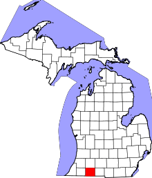 | |
| Villages | ||
| Townships | ||
| Unincorporated communities | ||
Coordinates: 41°55′24″N 85°31′42″W / 41.92333°N 85.52833°W