Central German Metropolitan Region
| Central German Metropolitan Region | |
|---|---|
 The Central German Metropolitan Region is based on the red coloured urban areas in Saxony, Saxony-Anhalt, and Thuringia) | |
| Country |
|
| States |
|
| Area | |
| • Metro | 2,000 km2 (800 sq mi) |
| Population (2008)[1] | |
| • Metro | 2,400,000 |
| Time zone | UTC+1 (CET) |
| Website | http://www.mitteldeutschland.com/en/page/wirtschaft |
The Central German Metropolitan Region (German: Metropolregion Mitteldeutschland) is one of the so-called metropolitan regions in Germany. It is centered on the major cities of Leipzig and Halle, extending over Central German parts of the states of Saxony-Anhalt, Thuringia and Saxony. The Central German metropolitan region is the only one located entirely within the former East Germany.
Due to its poly-centric nature, it is not actually one metropolitan area in the geographic sense of the word as an agglomeration of nearby urban areas, rather it is a registered association,[2] the Europäische Metropolregion Mitteldeutschland e.V whose membership is composed of towns, cities, municipalities, and companies, colleges and chambers of commerce in these centers and whose representatives vote upon new members.[3] For example, Jena joined the Metropolitan Region in 2009.[4] The registered association owns the management company Metropolregion Mitteldeutschland Management GmbH. [5] As such it forms a planning and marketing[6] framework for the region while retaining the legal independence of its members.
History
Saxon Triangle (Sachsendreieck)
In 1997 the German Ministerial Conference for Regional Development declared the 'Saxon Triangle' (Dresden, Leipzig/Halle, and Chemnitz) as the seventh of 11 metropolitan regions in German.
Central German Metropolitan Region
Out of this initial conference the Initiativkreis Europäische Metropolregionen in Deutschland IKM (Initiative Group for European Metropolitan Regions in Germany) was formed in 2001[7] which developed the concept of the Central German Metropolitan Region in 2012.[8]
In 2013, Dresden and Magdeburg dropped out of the club and the membership has been focused more on cities and towns around Leipzig and Halle.
Members
The largest of the eight member cities are Leipzig in Saxony and Halle (Saale) in Saxony-Anhalt.
Member cities
The member cities have changed over time[3] and the current member cities are as follows:
- Leipzig (570,000 inhabitants)
- Chemnitz (245,500)
- Halle (Saale) (236,000)
- Jena (105,000)
- Gera (99,000)
- Zwickau (97,000)
- Dessau-Roßlau (87,000)
Except for Zwickau and Wittenberg, all towns hold the status of an independent city (i.e. a county-free city). Dresden and Magdeburg are no longer part of the organization. The surrounding catchment areas officially are not part of the metropolitan region, though generally added for statistical and practical purposes.
Counties
6 rural districts (similar to counties)(German:Landkreis) also subscribe to membership of the CGMR. [9]
Non-governmental partners
Apart from these administrative units, the metropolitan region publishes a list of industry partners which are official members of the regions planning framework.[10]
Demographics
All towns and cities in the so-called metropolitan region suffered population decline after German reunification; however in recent years the populations of Leipzig and Halle have been increasing again. Other urban areas, such as Dessau-Roslau are however still declining.[11][12]
Transport
The region is located at historically and presently important trade corridors in central Europe. The routes of several highways of the International E-road network as well as two major German expressways (A9 Munich-Berlin and A14 Dresden-Wismar) are running through it. Leipzig-Halle is a major railway hub along the Berlin–Palermo railway axis which is part of the Trans-European high-speed rail network. Other railway main lines connect it with Dresden, Frankfurt, Frankfurt Airport or Prague. Leipzig-Halle airport serves as the main airport of the region. It is the second largest fright airport in Germany and a hub of DHL express service.
The metropolitan region has set up a working group on traffic and mobility, the members of which are delegated from various regional stakeholders, i.e. state ministries, cities, counties and public transport associations.[13]
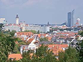
Gallery


References
- ↑ Deutsche-metropolregionen.org (PDF), BBR, Monitoring-Bericht 2010. Retrieved 6 September 2011.
- ↑ https://www.mitteldeutschland.com/de/page/organisation
- 1 2 http://www.region-mitteldeutschland.com/en/organisation/history/ Archived August 20, 2013, at the Wayback Machine.
- ↑ http://www.region-mitteldeutschland.com/organisation/historie/ Retrieved 4 October 2014. Archived October 6, 2014, at the Wayback Machine.
- ↑ https://www.mitteldeutschland.com/de/page/organigramm
- ↑ https://www.mitteldeutschland.com/en/page/objectives
- ↑ http://www.deutsche-metropolregionen.org/ueber-ikm/
- ↑ www.deutsche-metropolregionen.org/fileadmin/ikm/01_monitoring/Regionales_Monitoring_IKM_BBR_2013.pdf
- ↑ http://www.mitteldeutschland.com/de/metropolregion-und-mitglieder
- ↑ https://www.mitteldeutschland.com/de/page/verzeichnis
- ↑ "Archived copy" (PDF). Archived from the original (PDF) on 2014-04-20. Retrieved 2014-10-04. (PDF) Retrieved 4 October 2014.
- ↑ https://www.economist.com/news/international/21652314-growing-number-cities-will-have-plan-drastically-smaller-populations-rus
- ↑ https://www.mitteldeutschland.com/sites/default/files/uploads/2018/01/26/180123mitgliederagvemo.pdf
External links
Coordinates: 51°N 13°E / 51°N 13°E
| Authority control |
|---|