Cato Falls, Wisconsin
| Cato Falls, Wisconsin | |
|---|---|
| Unincorporated community | |
 Cato Falls, Wisconsin  Cato Falls, Wisconsin | |
| Coordinates: 44°05′56″N 87°53′30″W / 44.09889°N 87.89167°WCoordinates: 44°05′56″N 87°53′30″W / 44.09889°N 87.89167°W | |
| Country | United States |
| State | Wisconsin |
| County | Manitowoc |
| Elevation | 833 ft (254 m) |
| Time zone | UTC-6 (Central (CST)) |
| • Summer (DST) | UTC-5 (CDT) |
| Area code(s) | 920 |
| GNIS feature ID | 2760477[1] |
Cato Falls is an unincorporated community located in the town of Cato, Manitowoc County, United States.[1] The community is located just north of the Cato Falls of the Manitowoc River, 2.3 miles (3.7 km) north of Valders.
Notes
Municipalities and communities of Manitowoc County, Wisconsin, United States | ||
|---|---|---|
| Cities | 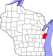 | |
| Villages | ||
| Towns | ||
| CDP | ||
| Unincorporated communities |
| |
| Footnotes | ‡This populated place also has portions in an adjacent county or counties | |
This article is issued from
Wikipedia.
The text is licensed under Creative Commons - Attribution - Sharealike.
Additional terms may apply for the media files.