Castleberry, Alabama
| Castleberry, Alabama | |
|---|---|
| Town | |
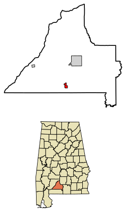 Location of Castleberry in Conecuh County, Alabama. | |
| Coordinates: 31°17′52″N 87°1′30″W / 31.29778°N 87.02500°W | |
| Country | United States |
| State | Alabama |
| County | Conecuh |
| Area[1] | |
| • Total | 1.73 sq mi (4.48 km2) |
| • Land | 1.71 sq mi (4.43 km2) |
| • Water | 0.02 sq mi (0.05 km2) |
| Elevation | 180 ft (55 m) |
| Population (2010) | |
| • Total | 583 |
| • Estimate (2017)[2] | 553 |
| • Density | 323.20/sq mi (124.80/km2) |
| Time zone | UTC-6 (Central (CST)) |
| • Summer (DST) | UTC-5 (CDT) |
| ZIP code | 36432 |
| Area code(s) | 251 |
| FIPS code | 01-12496 |
| GNIS feature ID | 0115688 |
Castleberry is a town in Conecuh County, Alabama, United States. At the 2010 census the population was 583.[3] Castleberry is known as the "Strawberry Capital of Alabama" and is home to the annual Castleberry Strawberry Festival.[4] Castleberry is also known for its "speed trap" with the confiscation of property happening on a regular basis. The town has five police officers. A lawsuit against former Police Chief Tracy Hawsey and the town of Castleberry is pending.[5]
Geography
Castleberry is located in southern Conecuh County at 31°17′52″N 87°1′30″W / 31.29778°N 87.02500°W (31.297899, -87.025027).[6]
According to the U.S. Census Bureau, the town has a total area of 1.7 square miles (4.5 km2), of which 0.02 square miles (0.05 km2), or 1.09%, is water.[3]
Demographics
| Historical population | |||
|---|---|---|---|
| Census | Pop. | %± | |
| 1900 | 167 | — | |
| 1910 | 225 | 34.7% | |
| 1920 | 313 | 39.1% | |
| 1930 | 427 | 36.4% | |
| 1940 | 609 | 42.6% | |
| 1950 | 667 | 9.5% | |
| 1960 | 669 | 0.3% | |
| 1970 | 666 | −0.4% | |
| 1980 | 847 | 27.2% | |
| 1990 | 669 | −21.0% | |
| 2000 | 590 | −11.8% | |
| 2010 | 583 | −1.2% | |
| Est. 2017 | 553 | [2] | −5.1% |
| U.S. Decennial Census[7] 2013 Estimate[8] | |||
As of the census[9] of 2000, there were 590 people, 257 households, and 150 families residing in the town. The population density was 344.0 people per square mile (132.4/km2). There were 331 housing units at an average density of 193.0 per square mile (74.3/km2). The racial makeup of the town was 63.22% White, 35.59% Black or African American, 0.85% Pacific Islander, and 0.34% from two or more races.
There were 257 households out of which 25.7% had children under the age of 18 living with them, 39.7% were married couples living together, 16.0% had a female householder with no husband present, and 41.6% were non-families. 37.7% of all households were made up of individuals and 18.3% had someone living alone who was 65 years of age or older. The average household size was 2.30 and the average family size was 3.05.
In the town, the population was spread out with 25.1% under the age of 18, 6.6% from 18 to 24, 27.6% from 25 to 44, 24.4% from 45 to 64, and 16.3% who were 65 years of age or older. The median age was 36 years. For every 100 females, there were 79.9 males. For every 100 females age 18 and over, there were 74.0 males.
The median income for a household in the town was $21,204, and the median income for a family was $30,000. Males had a median income of $27,386 versus $17,143 for females. The per capita income for the town was $13,154. About 21.8% of families and 26.6% of the population were below the poverty line, including 34.0% of those under age 18 and 29.2% of those age 65 or over.
Education
- Conecuh County Junior High School
References
- ↑ "2017 U.S. Gazetteer Files". United States Census Bureau. Retrieved Jul 7, 2018.
- 1 2 "Population and Housing Unit Estimates". Retrieved March 24, 2018.
- 1 2 "Geographic Identifiers: 2010 Demographic Profile Data (G001): Castleberry town, Alabama". U.S. Census Bureau, American Factfinder. Retrieved June 9, 2014.
- ↑ http://www.frontiernet.net/~sharonj.
- ↑ http://www.al.com/news/index.ssf/2017/10/post_153.html
- ↑ "US Gazetteer files: 2010, 2000, and 1990". United States Census Bureau. 2011-02-12. Retrieved 2011-04-23.
- ↑ "U.S. Decennial Census". Census.gov. Archived from the original on April 22, 2013. Retrieved June 6, 2013.
- ↑ "Annual Estimates of the Resident Population: April 1, 2010 to July 1, 2013". Retrieved June 3, 2014.
- ↑ "American FactFinder". United States Census Bureau. Archived from the original on 2013-09-11. Retrieved 2008-01-31.
External links
Coordinates: 31°17′52″N 87°01′30″W / 31.297899°N 87.025027°W
Municipalities and communities of Conecuh County, Alabama, United States | ||
|---|---|---|
| City | 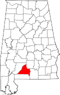 | |
| Towns | ||
| Unincorporated communities | ||
| Footnotes | ‡This populated place also has portions in an adjacent county or counties | |