Carlisle, Louisiana
| Carlisle, Louisiana | |
|---|---|
| Unincorporated community | |
 Carlisle, Louisiana  Carlisle, Louisiana | |
| Coordinates: 29°41′13″N 89°57′44″W / 29.68694°N 89.96222°WCoordinates: 29°41′13″N 89°57′44″W / 29.68694°N 89.96222°W | |
| Country | United States |
| State | Louisiana |
| Parish | Plaquemines |
| Elevation | 7 ft (2 m) |
| Time zone | UTC-6 (Central (CST)) |
| • Summer (DST) | UTC-5 (CDT) |
| ZIP code | 70040[1] |
| Area code(s) | 504 |
| GNIS feature ID | 541063[2] |
Carlisle is an unincorporated community in Plaquemines Parish, Louisiana, United States. Carlisle is located on the east bank of the Mississippi River and Louisiana Highway 39, 19.3 miles (31.1 km) south-southeast of New Orleans.[3]
References
- ↑ United States Postal Service (2012). "USPS - Look Up a ZIP Code". Retrieved 2012-02-15.
- ↑ "Carlisle". Geographic Names Information System. United States Geological Survey.
- ↑ Plaquemines Parish Northwest Section (PDF) (Map). Louisiana Department of Transportation and Development. 2012. Retrieved September 2, 2012.
Municipalities and communities of Plaquemines Parish, Louisiana, United States | ||
|---|---|---|
| CDPs | 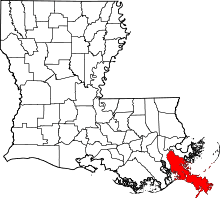 | |
| Unincorporated communities |
| |
| Ghost towns | ||
This article is issued from
Wikipedia.
The text is licensed under Creative Commons - Attribution - Sharealike.
Additional terms may apply for the media files.